.About CIROH

Large

About CIROH @ UVM
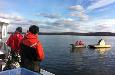
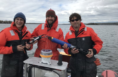
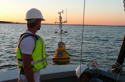
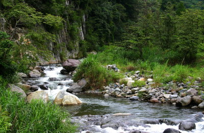
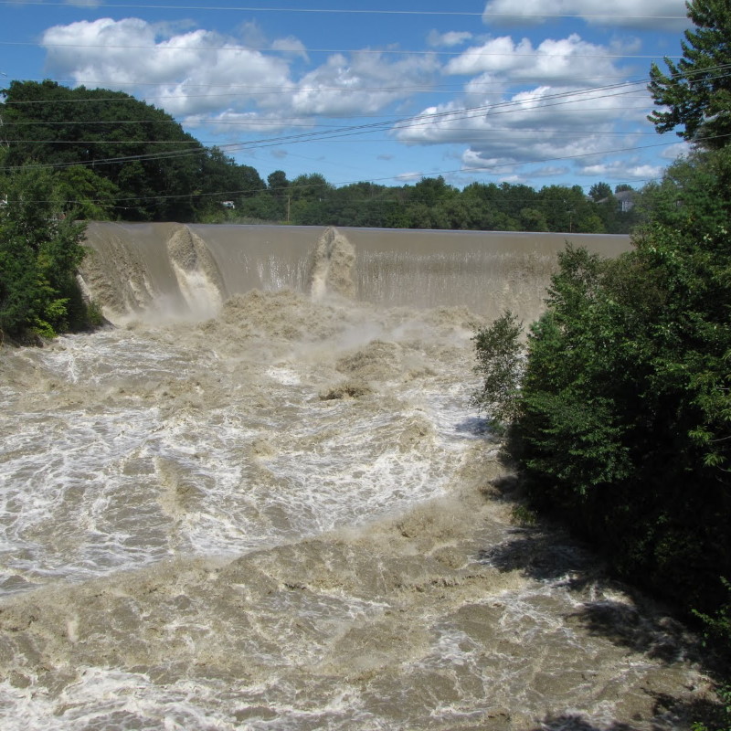
The Cooperative Institute for Research to Operations in Hydrology (CIROH) is a national consortium of science and services to provide actionable water resources intelligence to improve a national water model and flood forecasting.
 
CIROH works closely with the National Oceanic and Atmospheric Administration’s (NOAA) National Water Center and the U.S. Geological Survey Hydrologic Instrumentation Facility allowing for highly productive collaboration between CIROH’s cooperative members and other federal agency scientists.
 
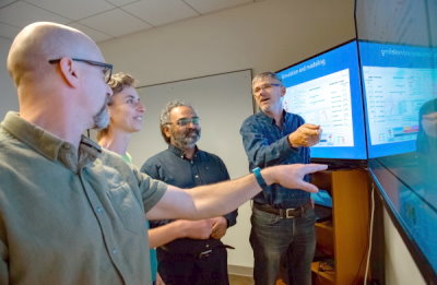
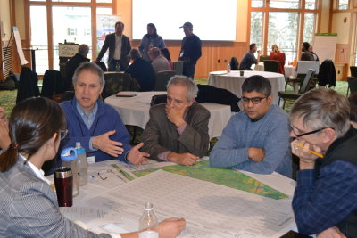
Headquartered at the University of Alabama Water Institute (AWI), CIROH consists of academic institutions, non-profit organizations, and government and industry partners across the United States and Canada.

Research

Small
Research Themes

Researchers at UVM collaborate with other partners in the CIROH initiative to advance NOAA’s capabilities in the below four themes, particularly community water resources modelling and its application to social, economic, and behavioral sciences.

Water Resources Prediction Capabilities


The Water Resources Prediction team works on improving representation of floodplains and natural features for channel routing in the National Water Model. More...

Community Water Resources Modeling


The Modeling team works on building advanced cyberinfrastructure resources necessary to fuse a diverse array of existing and new heterogeneous data sources for supporting expanded evaluation data testbeds in the Northeast.
 
Additional work includes forcasting the incidence and duration of harmful algal blooms (HABs) at daily, weekly and seasonal scales. More...

Hydroinformatics


The Hydroinformatics team works on leveraging emerging sensing technology and machine learning to improve and expand hydrological forecasting to hyper-local scales with National Water Model-coupled adaptive sensor networks.
 
Additional work includes:
 
Post-processing National Water Model output with spatially distributed turbidity sensing to forecast turbidity loading and source for reservoir operation management
 
Coupling novel low cost spatially distributed nutrient sensors and National Water Model output to forecast nutrient loading and inform state implementation of EPA mandated nutrient reduction targets. More...

Application of Social, Economic, and Behavioral Science to Water Resources Prediction


The Social Science team works on enhancing forecast design through experimental gaming and social impact assessment of connected river and floodplains.
 
Additional work includes developing a CIROH forecast design center to explore the heterogeneity of risk perception and behavior, and decision heuristics relative to water hazard mitigation that can be integrated into National Water Model products. More...

.Job Opportunities

Small
Job Opportunities

Would you like to work with the CIROH @ UVM team? The following positions are currently available and additional graduate opportunities will be posted soon. Interested applicants should contact the project investigators listed in each position.

Research Assistant
Floodplains Research


The CIROH @ UVM Floodplains Team is seeking a Research Assistant to assist with the management and manipulation of large geospatial and environmental datasets for characterizing river and floodplain morphology and hydraulic parameterization of flood routing and inundation mapping. More...

Research Computing Facilitator
Data Assimilation


The CIROH @ UVM Harmful Algal Blooms (HABs) Forecasting Team is seeking a Research Computing Facilitator to manage and manipulate large, heterogeneous datasets for assimilation into models (both physics-based and machine learning / artificial intelligence (ML/AI)) that are being developed to forecast HABs in Lake Champlain.
 
This position is no longer accepting applications.

Post Doctoral Scholar
Flood Warning Communication


We seek a postdoctoral researcher with interest in flood hazards and science communication research to join an interdisciplinary team at the University of Vermont (UVM) on a NOAA-funded project to investigate how new flood warning tools will be interpreted and used by multiple public audiences.
 
This position is no longer accepting applications.

Post Doctoral Scholar
Montane Headwater Hydrology


We seek a postdoctoral scholar with expertise in montane headwater catchment hydrology and experience working with large water quantity and geospatial datasets.
 
This position has been filled.

Post Doctoral Scholar
Hydrologic and Geomorphic Data Scientist


We seek a postdoctoral scholar with expertise in computational methods, hydroinformatics, and modeling to contribute to research on channel-floodplain connectivity and its influence on flood routing.
 
This position has been filled.

Post Doctoral Scholar
Nature-based Solutions for Mitigating Flood Impacts


We seek a postdoctoral scholar with expertise in ecosystem services and spatial modeling to join a NOAA-funded interdisciplinary project on the social costs of flooding.
 
This position has been filled.

Post Doctoral Scholar
Nutrient Sensor Development


We seek a postdoctoral scholar with expertise in sensor development applicable to nutrient sensing in water bodies that has interest in advanced wireless sensing technologies for environmental applications.
 
This position has been filled.

Post Doctoral Scholar
Nutrient and Sediment Transport


We seek a postdoctoral scholar with expertise in the fate and transport of nutrients and sediment in watersheds that has interest in applying machine learning applications to study temporal and spatial drivers of water quality.
 
This position has been filled.

Post Doctoral Scholar
Flood Hazard Risk and Uncertainty Communications


We seek a postdoctoral researcher with expertise in risk and uncertainty communication to join a NOAA-funded interdisciplinary project on the social costs of flooding.
 
This position has been filled.

Hydro informatics Research Analyst
Computing and Data Analytics


We seek a computational data scientist with experience developing applications using large, environmental datasets.
 
This position has been filled.

Research/Lab Technician
Water Quality and Environmental Change


The Department of Geography and Geosciences at the University of Vermont has an open position for a qualified and motivated Research/Lab Technician to join Dr. Andrew Schroth’s Water Quality and Environmental Change Laboratory (WQECL).
 
This position has been filled.

Research Technician
Field Data


The Department of Geography and Geosciences at the University of Vermont has an open position starting March 1, 2023 for a qualified and motivated Research Technician.
 
This position has been filled.

Ph.D. Student
Channel Routing in the National Water Model


We seek candidates interested in pursuing a doctoral degree in our research group at the University of Vermont to improve understanding and modeled representation of the influence of floodplain-channel connectivity on flood celerity and flood routing processes.
 
This position has been filled.

Supporting Data & Data Dashboards

Medium
Supporting Data & Data Dashboards
Explore web-based dashboards with meteorological and water quality data from our environmental sensor network, download datasets from our environmental monitoring and modeling efforts.

Dashboard:

Lake Carmi Water Quality Data


Water quality and meterorological data from our buoy at Lake Carmi.
 
Updated at 08:30, 12:30 and 16:30 each day. More...

Dashboard:

St. Albans and Missisquoi Bay Water Quality Data


Water quality and meterorological data from our buoys in St. Albans Bay and Missisquoi Bay.
 
Updated at 08:30, 12:30 and 16:30 each day. More...

Dashboard:

Lake Champlain Inland Sea Weather Data


Meterorological data from our buoy in Lake Champlain's Inland Sea posted at the NOAA National Data Buoy Center. More...

Data:

Streams Data


Water quality data collected by our high school education outreach program from streams across Vermont. Available data include macroinvertebrates, E. coli, phosphorus and nitrogen. More...

Supporting Publications