
Louis L. McAllister
July 27, 1938
Sarah L. Graulty
October 29, 2006

Grove Street: North to Bridge UTM: 180644378E; 4927228N |
|
|
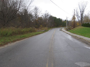
In 1937, due to increasing traffic on Grove Street, a city Street Department official wrote, “it is proposed to construct a small bridge under W. P. A. participation during the coming year.”[1] Indeed, by 1938, the project to replace the old wooden plank/dry stone wall was underway. That year, the Street Department wrote in the Annual Report that “for several years Grove Street Bridge has been inadequate for the traffic but funds have not been made available until this year for the replacement of this old wooden structure.”[2] Work began on the W. P. A. bridge in June1938. This image, dated July 27, 1938, shows the construction of the Grove Street Bridge in its early stages. McAllister took this photograph facing in a northerly direction to bridge site and beyond. In it, we see various pieces of construction equipment. He also captured the project on this date from several other viewpoints. To view the bridge mid-construction from other perspectives, please click here. McAllister also captured a historic barn in this photo, which is barely visible on the slope behind the bridge. The barn is distinguished by its wide, eaves-front roof topped by a cupola. The structure appears on Burlington Sanborn Fire Insurance Maps as far back as 1889. This photo was taken in front of the W. C. Kirby Garage, whose driveway can be seen to the right before the bridge and after the telephone pole. W. C Kirby, who lived at north of this point at 63 Grove Street (barely visible above), ran a trucking and construction company that was expanding in size and scope during this time. From the 1930s to the 1950s, the Burlington directories suggest that Kirby's business grew from "trucking" to "ready mix concrete, contractor, and excavating" by 1954[3], the approximate year of his death. His wife, Mrs. Madeleine F. Kirby, continued as administrator of the estate after 1956[4] and the Burlington directory suggests that the plant continued operation at 100 Grove Street until approximately 1974. Please click here to see an image from this same perspective in 1940 in which the bridge construction has been completed and the barn is more clearly visible. [1] Burlington City Annual Report, 1937, p. 195
|
Today, very little remains of the 1938 Grove Street Bridge. To view the bridge today accompanied by a description, please click here. Although obscured by trees, the sloped area on the left hand side of the road in Louis McAllister's photograph has since been transformed into a park. In 1942, the Parks Commissioners noted in the Annual Report, "An important addition to the city's park system came in the form of two parcels of land, totaling approximately seven acres and located on Grove Street. This was the gift of Mrs. Pearl E. Schmanska, in memory of her late husband, and is to be fully developed for both a summer and winter playground."[1] The park featured a playground, baseball field, skating rink and warm up house, toilet facilities and other attractive facilities. Very soon after its opening, Schmanska Park was already a source of community pride. "A fine spirit of civic cooperation has developed around this park with neighbors joining together along with their children in planning and conducting a wholesome and varied program," wrote W. L. Hammond, Superintendent of Parks, in 1943.[2] Today, the baseball field and skating rink are gone, having been replaced by tennis and basketball courts. Schmanska Park also offers a large playground and indoor meeting facilities in its barn. The historic barn, which appears in the background of several historic McAllister photographs, was recently renovated by William Maclay Architects & Planners of Waitsfield, Vermont. The firm's website testifies that all work was done "within historic preservation requirements" and "existing siding, trim, cupola and other historic features were maintained."[3] The barn is obscured by tree growth in contemporary photos taken from McAllister's viewpoints, but to see a picture of the barn as it stands today, please click here. [1] Burlington City Annual Report, 1942, p. 129. |
Historic Burlington Project Depression Era Streetscapes: Old North End | Burlington 1890 | Burlington 1877 | Burlington 1869 | Burlington 1853 | Burlington 1830 Produced by University of Vermont Historic Preservation Program graduate students in HP 206 Researching Historic Structures and Sites - Prof. Thomas Visser - in collaboration with UVM Landscape Change Program Historic images courtesy of University of Vermont Library Special Collections, Louis L. McAllister Photograph Collection |