
The most detailed imagery and terrain models you have ever seen. All geo-referenced, ready for intergration into your CAD and GIS within 12 hours from the flight.
Orthorectified true color or color infrared imagery with resolutions as high as 3cm. Horizontal accuracy better than 10cm can be achieved.
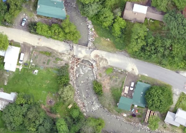
3D point clouds, similar to LiDAR, generated through photogrammetric processing. The point clouds provide stunning visuals and are accurate enough to make vertical measurements to within centimeters.

3D solid surface models suitable for GIS and CAD analysis and deriving contours.

Turning UAS data to information.

No need for fancy software, the UAS imagery can be viewed in a web browser.
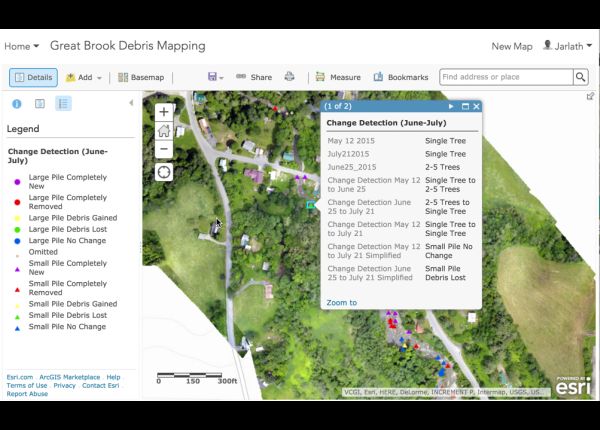
Full mobile intergration, for any portable needs. See the imagery while on the move or on site.
