 Projects: Where and How We WorkProjects: Where and How We Work
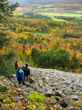
Field Naturalists and Ecological Planners get outside and find answers. Students bring their skills in science, fieldwork, communications and problem solving to bear on a genuine field project for a sponsoring organization. This constitutes our program's Masters requirement.
Projects take FNEPs far afield: to Puerto Rico to create coummunity-wide ecological assessment, to the High Sierra to track the tree-killing White Pine Blister Rust, or to Maine to discover and map remote forests in Baxter State Park. Students work in collaboration with a sponsoring conservation organization – The Nature Conservancy, the National Park Service, a stage agency or a municipal parks department, for example.
The Masters product includes a professional report for the sponsoring organization, written academic reflections, and a journal publication or article in the popular mass media. Below are a few examples of where FNEPs have been working lately.
Inhibiting Invasives
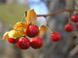
Clare Crosby hunts green invaders. Working with The Nature Conservancy and the Vermont Land Trust, Clare is developing new thinking on invasive plant species near nature preserves in Vermont's Champlain Lowlands. Plants don't recognize property lines. So Clare also works with private landowners to recognize larger distribution patterns for the invaders. The result will be smarter controls of invasive plants on private and public lands alike.
Woodland Walks
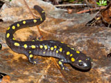
In the Maine woods salamanders converge on vernal pools for a once-a-year orgy. Gray Jays float like ghosts through forests of spruce and fir. And treasures on any hike range from moose to mushrooms. Kelly Finan walked some of Maine's exquisite paths to produce a suite of "natural heritage trail guides." Working with the Maine Natural Areas Program, Kelly intends to get day-hikers to stop and experience the diversity of life at each and every step.
Chasing Calcium
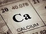
Calcium happen. And it matters to forests and people. Gus Goodwin hunted calcium in glacial till at sites in Vermont's Green Mountains. And not once did he swing a rock hammer or dig a pit. Instead Gus found calcium data in maps field notes, and long-forgotten research. Working for the Green Mountain National Forest, Gus produced a GIS map of bedrock calcium and model to help land managers identify productivity, diversity and vulnerability in forests – based in part on calcium in bedrock. Gus now gets outside to verify his model.