     |
|
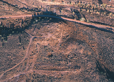
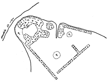
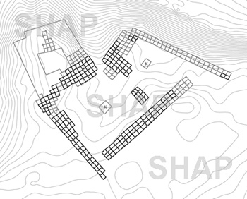
FOURMILE RUIN
Fourmile Ruin (AZ P:12:4 ASM) is the largest Ancestral Pueblo village in the Silver Creek drainage.
The village was likely established at the close of the thirteenth century followed by major architectural expansion in the early fourteenth century. Pottery from the site suggests that the settlement was abandoned by 1400.
Jesse Walter Fewkes excavated portions of the village in 1897, recovering a large corpus of decorated pottery now housed at the Smithsonian Institution. Leslie Spier mapped the ruins several years later. Little professional archaeological work has taken place since these early projects. The site was systematically looted in recent decades.
The Archaeological Conservancy acquired the site in 2003.