Manufacturing in the Maple-Kilburn Area of Burlington, Vermont
By Kate Hovanes
The Maple-Kilburn area, encompassing the area along Battery, South Champlain, and Pine Streets bound by Maple Street in the north and Kilburn Street in the south, is an area rich in manufacturing history. From before 1869 until the present wide range of companies have conducted manufacturing, in industries as diverse as spool and bobbin making, Venetian blind crafting, marble and granite finishing, and candy and cigar making. Whether presenting wares at state fairs or installing their products in the Empire State Building, the Maple-Kilburn businesses were all important in bringing Burlington's manufactured products to the national stage.
All told, this page will discuss fifteen different companies and buildings. In the case of a number of these, companies were located in structures erected by previous corporations but have been separated out to allow for a more detailed analysis. Some businesses were more successful, some operated for longer, some suffered worse disasters, some relate more closely to manufacturing than others; some have considerably more information available than others. All of these factors have influenced the length and detail of each section.
Area Timeline
1849—Vermont Central Railroad and Rutland and Burlington Railroad begin operations
1866—Burlington Manufacturing Company opens as rolling mill and nail factory
1869—W. L. Stone's Brewery and Malt House appears on Sanborn map
1869—Rutland Railroad Roundhouse first appears on Sanborn map
1870—Arbuckle & Co. begins operation
1870s—Burlington Manufacturing Company shifts to marble and granite manufacturing
1875—J. W. Goodell Granite and Marble Company begins operation
1884—Burlington Venetian Blind Company begins production
1885—Plaster Mill first appears on Sanborn map
1885—Planing Mill first listed on Sanborn map
1886—Arbuckle & Co. expands factory on Maple Street
1889—Brewery and Malt House no longer listed
1889—Ferguson Brother's Ice House first appears on Sanborn maps
1892—Burlington Beef Company warehouse built
1894—The Venetian Blind Company and Burlington Blind Company consolidate operations
1900—Plaster Mill no longer listed on Sanborn map
1901—Burlington Manufacturing Company no longer listed in Burlington City Directory
1905—Fire partially destroys Rutland Railroad Roundhouse
1905—Vermont Spool and Bobbin Manufactory begins operation
1906—E. F. Moore Manufactory of Concrete Building Blocks appears in Sanborn map
1909—Fire destroys Rutland Railroad Roundhouse
1912—Ferguson Brother's Ice House no longer appears on Sanborn map
1916—Arbuckle & Co. bankrupt
1916—Paper Tube & Box Company begins operation in Arbuckle & Co.'s old factory
1918—M & F. C. Dorn Bottling Company listed in Burlington City Directory
1918—Rutland Railroad replaces old roundhouse with a new structure
1925—Goodell & Co. no longer listed in Burlington City Directory
1925—Wharf Lane Apartments building built by G. S. Blogett Company as an oven manufacturing plant
1926—Loose-Wiles Biscuit Co. first listed on Sanborn map
1926—National Biscuit Company appears on South Champlain Street in Sanborn map
1931—Burlington Venetian Blind Company commissioned to provide blinds for the Empire State Building
1938—Arbuckle building occupied by a variety of retail establishments
1942—Loose-Wiles Biscuit Co. no longer appears on Sanborn maps
1952—General Electric purchases Wharf Lane Apartment building from Blogett for use as a wire assembly plant
1953—Venetian Blind Company ceases operation
1976—Spool and Bobbin Manufactory ceases operation
1977—M & F. C. Dorn Bottling Company ceases operation
1978—National Biscuit Company no longer appears on Sanborn map
1978—General Electric moves wire manufacturing plant from Wharf Lane Apartment building
1978-1980—Wharf Lane Apartment building sold to Pizzagalli Realty
1980—Ben & Jerry's located in Spool and Bobbin building
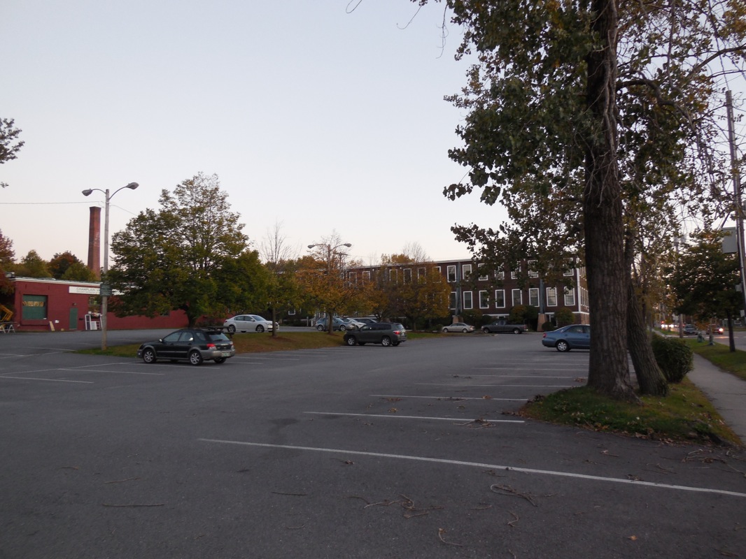
The section of Burlington between Maple and Kilburn is unusually rich in surviving manufacturing buildings, many from quite significant companies. Unfortunately, the Burlington Venetian Blind Company's manufacturing plant is, for the most part, not among those surviving structures (see Figure 1). One of the longest operating manufacturing companies in the Maple-Kilburn area, the Burlington Venetian Blind Company began business in 1884 as the Venetian Blind Company, and continued to produce blinds until 1953.1 Figure 1. The area in which the blind factory formerly stood. Photograph by Kate Hovanes, Oct. 2013.
Although it is chronologically closest to the opening of the factory, the 1885 Sanborn map did not cover the area with the blind company. However the 1889 map did, showing a large, two-story wood framed building, approximately 150 feet long and 50 feet wide. According to the map, woodwork was conducted on both floors, while varnishing and packing were relegated to a small room on the south end of the factory while various storage and lumber facilities were offset from the main building.2
Just one year after opening, the Venetian Blind Company had already become notable among Burlington's manufacturing businesses. In 1885, it participated in the Vermont State Fair with an exhibit that had previously been used in an exposition in New Orleans, which included two model windows to demonstrate the company's patented "inside sliding blind" as well as its Venetian blinds, in various woods including cherry, spruce, and pine.3
However, the company's business at the time extended far beyond Vermont, and even the United States. An 1885 article in the Burlington Free Press noted that the Venetian Blind Company was filling a large order for "the public schools…of one of the largest cities in the country." They were also shipping blinds to New Zealand, Australia, Germany, England, and even South America.4 The fact that by 1888 the Blind Company's shifts were running extra quarter days to meet its customer's demands further demonstrates its rapid rise to success.5
Figure 2. Illustration of the Venetian Blind Company's venetian blinds, from an 1890s sales pamphlet. Image courtesy of University of Vermont Special Collections.
This success continued as the blind company became more firmly established. In 1890 the Venetian Blind Company received an order for 350 windows in Arkansas.6 A pricelist from that same year gives a sense of what customers such as those in Arkansas would have been able to select from (please see Figure 2 for an illustration of the company's blinds). From the company's "Improved Venetian Blinds" list, a customer would have been able to select blinds made of fifteen different woods, ranging from spruce to mahogany, priced from 23 to 50 cents per square foot. Customers would also have the option to buy the company's patented sliding blinds, which also came in a wide variety of woods and prices to suit any budget.7 The 1911 Sweet's Catalogue of Building Construction gave further details about the operation of the company's products:
Our Venetian Blinds…are attached to windows by brackets…The slats are hung on interwoven ladder tape in various colors and operated by braided cords by which light and ventilation can be instantly controlled…Sliding Blinds…are usually made in three sections in height, the two upper ones having stationary slats and the lower one rolling slats…These sections may be at various elevations in the windows as suits best for admission or exclusion of light.8
The volume of materials the Venetian Blind Company utilized to manufacture these products is remarkable. As the Burlington Free Press announced in 1891, "The Venetian Blind company used in finishing their blinds and screens in the year 1891 over 5500 gallons of oil and varnish and over two tons of colors..." Although merely listing numbers does not give a sense of how the Venetian Blind Company stacked up with other manufacturers in the area, the conclusion of the Free Press certainly does: the statistics gave "…some idea of the enormous amount of business being done by this enterprising company." 9 The fact that the press felt these numbers worth commenting upon demonstrates the importance of the Blind Company within the Burlington manufacturing industry. This remarkable productivity continued despite a number of setbacks through the 1890s and early 1900s, including the 1893 depression, a series of lawsuits, and even physical damage to the building itself.
Less well known than the Great Depression, the Depression of 1893 was still an extremely significant economic downturn in American history. As the historian David Whitten noted in his essay "The Depression of 1893," "the Depression of 1893 was one of the worst in American history with the unemployment rate exceeding ten percent for half a decade." 10 Despite the dire economic situation of the time, the Venetian Blind Company still enjoyed its most profitable year thus far in 1893. As stated in the report of the annual meeting, "The manager reported an abundance of orders, which is rather remarkable, considering the state of the general business of the country." 11
The Venetian Blind Company also faced challenges on a more local level. In 1893, it filed three suits against the Burlington Blind company, a rival corporation also in the area. The first, which the court ruled against in June, involved an injunction filed by the Venetian Blind Company against the Burlington Blind Company for using the word "Burlington" in its name. The court decided that the Venetian Blind Company had no special right to the use of the word "Burlington." 12 In September that same year, the Venetian Blind Company filed two more suits. One suit revolved around an infringement on the Venetian Blind Company's inside sliding blinds. The second was for other alleged patent infringements of the company's Venetian blinds.13 However, these legal setbacks did not prevent the company from profiting. In 1893, the Blind company employed approximately 80 workers, and ran the plant at quarter time extra as well.14
Remarkably, the resolution to the legal issues ended up being a consolidation of the two companies in 1894 into a single new corporation, under the name of the "Burlington Venetian Blind Company." Since the issue revolved around patents, combining the two companies, as the Burlington Free Press article reporting the merger succinctly explained, "…vests the ownership of all the patents in issue in the new company and settles the whole trouble." The merger precluded further issues between the two companies.15
The trouble did not end there, however. In 1903 a 60 foot smoke stack belonging to the blind factory fell on the building after workers stringing power cables inadvertently pulled it over. No workers were injured in the accident, but the smoke stack had to be replaced. Its replacement was a new seventy-foot-tall brick chimney, seven square feet at the base and three and a half feet square at its top, the dimensions of which give a sense of the factory's size.16
Despite these setbacks, the Venetian Blind Company continued to profit and grow throughout the following decades. The Sanborn maps attest to this through the physical expansion of the plant. The 1919 Sanborn map showed a new third story on the main woodworking building, while the 1926 map showed even more growth, with the previously separate eastern storage building had been connected by the entire front façade (see Figure 3).17
Figure 3. Detail of the Venetian Blind Factory from the 1919 Sanborn map. Image courtesy of UVM Center for Digital Images.
The most notable achievement by the Venetian Blind Company, however, came in the 1930s, when in 1931 the Burlington Venetian Blind Company was commissioned to supply Venetian blinds for the newly erected Empire State Building, at the time the tallest building in the world. An advertisement in Burlington Magazine attests to the company's pride in its remarkable achievement for Burlington manufacturing.18
This success continued through the 1930s. For example, the 1938 Sanborn map showed that the blind factory had continued to expand from the 1920s, including increased size of facilities and a more integrated central plant area, perhaps to increase efficiency or to simply give workers more room to produce the blinds.19 However, it appears that after the 1930s the blind company began to wind down. Unlike in previous decades, between 1938 and 1942, the plant did not expand.20 Although it is listed in business directories up until 1952, by 1954 the Burlington Venetian Blind Company was no longer listed in the Burlington City Directory.21
Little is left to mark the historical location of the Burlington Venetian Blind Company. A parking lot now rests where its woodwork and varnishing building once stood, and the only physical remnant of the building is the storage shed, which now houses a restoration business and a yoga studio (see Figure 1). Despite its closure, and the disappearance of most of the blind company's buildings, the Venetian Blind company represents a remarkable story of manufacturing success, success which helped to put Burlington on the national, and international, stage.
Notes (Venetian Blind Co.)
1 "An Important Consolidation," Burlington Free Press (Burlington, VT), June 21, 1894. Manning's Burlington Winooski and Essex Junction Directory (Springfield, MA: H. A. Manning Co, 1952), 404. 2Insurance Maps of Burlington, Vermont (New York: Sanborn Map & Publishing Co., Jan. 1885), Sheet 12. 3 "Howard Park Exhibition," Burlington Free Press (Burlington, VT), Sept. 11, 1885. 4 "City and Vicinity," Burlington Free Press (Burlington, VT), Oct. 30, 1885. 5 "Home Matters," Burlington Free Press (Burlington, VT), Oct. 26, 1888. 6 "All Over the State," Burlington Free Press (Burlington, VT), Jul. 25, 1890. 7 Venetian Blind Co., Price List of Hill's Patent Sliding Blinds and Improved Venetian Blinds, 1890. 8 "Burlington Venetian Blind Co.," Sweet's Catalogue of Building Construction (New York, NY: The Architectural Record Co.: 1911), 808, accessed Nov. 10, 2013, http://books.google.com/books?id=untNAAAAYAAJ&dq=1911%20sweets%20catalogue&pg=PR19#v=onepage&q=1911%20sweets%20catalogue&f=false. 9 "Vicinity Matters," Burlington Free Press (Burlington, VT), Jan. 14, 1892. 10 David O. Whitten, "The Depression of 1893," Economic History Association, Feb. 1, 2010, http://eh.net/encyclopedia/article/whitten.panic.1893. 11 "The Venetian Blind Company," Burlington Free Press (Burlington, VT), June 15, 1893. 12 "The Injunction Dissolved," Burlington Free Press (Burlington, VT), June 8, 1893. 13 "Suits for Infringement," Burlington Free Press (Burlington, VT), Sept. 28, 1893. 14 "Home Matters," Burlington Free Press (Burlington, VT), Sept. 14, 1893. 15 "An Important Consolidation," Burlington Free Press (Burlington, VT), June 21, 1894. 16 "City News," Burlington Free Press (Burlington, VT), Apr. 9, 1903; "City News," Burlington Free Press (Burlington, VT), Jul. 2, 1903. 17Insurance Maps of Burlington, Vermont (New York: Sanborn Map Co., May 1919), Sheet 18; Insurance Maps of Burlington, Vermont (New York: Sanborn Map Co., Apr. 1926), Sheet 23. 18 "Venetian Blinds Extend Burlington's Fame," Arthur G. Crane, p.8, Burlington Magazine, 1931. 19Insurance Maps of Burlington, Vermont (New York: Sanborn Map Co., Jun. 1938), Sheet 23. 20 Ibid., 1938 Insurance Map, Sheet 23; Insurance Maps of Burlington, Vermont (New York: Sanborn Map Co., 1942), Sheet 9. 21Manning's Burlington Winooski and Essex Junction Directory (Springfield, MA: H. A. manning Co;, 1952), 63. Ibid., 1954, 66.
Marble and Granite Works: Burlington Manufacturing Company and J. W. Goodell Marble and Granite
Figure 4. The Burlington Manufacturing Company's marble works, as shown on the 1894 Sanborn map. Image courtesy of UVM Special Collections.
With the changing material needs of the state and the nation, and with changes in the economic fortunes of the companies' owners, the manufacturing plants located in the Maple-Kilburn area went through constant changes throughout the area's history. Two companies that perhaps most vividly evoke those shifts in the physical layout of the area and the changes in occupancy are the Burlington Manufacturing Company and the J. W. Goodell Marble and Granite Company. Little remains to indicate that two important marble manufacturing companies once stood between Pine and South Champlain streets, just north of Kilburn—an area now dominated by artists' studios, an akido studio, and a flooring store.
The Burlington Manufacturing Company initially opened in 1866 as a rolling mill and nail factory, located in the same location as the later marble mill.1 The iron works consisted of two main buildings, one a rolling mill, the other (slightly to the south), a nail factory.2 Although ironwork may seem like a strange contrast to the company's later stone work, there was a high demand for iron products. As the Burlington Free Press enthusiastically reported in 1867, the iron works
…rank among our large establishments. The rolling mill is 75 by 140 feet, with boiler-room 30 by 40 feet, and contains three trains of rolls…The mill rolls 100 tons per week. Among the improvements now making, is the machinery for manufacturing a new patent horse-shoe…in month from this date they expect to make at the rate of 10 tons per day sic…
Both the equipment for manufacturing and even the fuel used in the boilers were locally sourced—the rolls for the mill were locally cast at the foundry of Brink & Snailey, and the boilers were heated with shavings from L. Barnes' planning mill, located to the south.3
However, by 1870s the Burlington Manufacturing Company underwent a change in industry. Although historic sources do not record a year when the iron works stopped operating, a Burlington Free Press article reporting the installation of the rolling mill's seventy-five horse power engine in the local plaster mill for use in crushing Nova Scotia plaster suggests that it may have stopped production by the early part of the decade.4
Regardless, it is well documented that at some point in the 1870s the Burlington Manufacturing Company changed industries, and the marble and granite works began operation (see Figure 4). Two companies actually made up the marble works—the Burlington Manufacturing Company, and the J. W. Goodell Granite and Marble Company (which will be referred to here as "Goodell & Co."). Goodell & Co. began business in 1875 under the control of Goodell, Hayward and Smith, with eight employees, and in 1885 J. W. Goodell assumed full control of the company.5
Although they were close in proximity and worked in conjunction, the Burlington Manufacturing Company and Goodell & Co. were not to be confused, as a remarkably informative Burlington Free Press article from 1879 makes clear. The two companies certainly did work closely together—for example, Goodell rented its facilities and acquired the power required to run them from the Manufacturing company. This partnership was intentional. As the article noted, "Three years ago, intending to confine themselves chiefly to sawing marble and to marble times, they [the Burlington Manufacturing Company] turned over the finishing business…" to the Goodell company. This shift may have been made to conserve the more profitable aspects of the business, while allowing another company to do the more difficult or expensive operations.6
In any case, the arrangement worked well for Goodell & Co. By 1879, the business had expanded from eight employees to eighty, and was described by the Free Press as "…one of the most active, extensive and successful of our manufacturing enterprises." Interestingly enough, the Free Press attributed the success not just to business acumen but also to improvements in technology:
The improvements in machinery for dressing and finishing marble have been very great during the last ten years, and have affected almost as great changes in the business as the substitution of machinery for hand work…in furniture…
The extensive list of the various machines used by Goodell & Co. in finishing marble certainly bears out this assertion. The firm used fifteen different machines to create its products, including a turning lathe, molding cutters, and a wide variety of polishing machines. The number of back-orders even required that the molding cutters remained in use constantly, day and night. One of those orders included the brownstone used for the YMCA building in downtown Burlington at 129 Church Street (since destroyed by fire).7
The Burlington Manufacturing Company also enjoyed considerable success. Having left the finishing of marble to Goodell, the company specialized in sawn marble and tile flooring. Like the Goodell Company, the mills were run at full capacity to meet demand, with a staff of 50 employees. Marble was shipped to places as far away as California. The Free Press even mentioned that at the time of publication they had "…on hand in their storehouses, awaiting shipment, probably the largest stock of tile flooring in the United States." This success would continue through the end of the nineteenth century.8
The marble manufacturers' prominence also continued to grow. J.W. Goodell & Co. exhibited around $13,000 worth of their finest merchandise at the 1882 State Agricultural Society's annual fair. The wares displayed included a number of marble monuments in various marbles from Vermont, New York, Tennessee and Italy—all marbles commonly used by the company.9
As with earlier news stories, the report also noted that "there is no larger or more enterprising house in the business in the State than Messrs. Goodell & Co. of Burlington." Although those words might appear perfunctory to a modern reader, an 1890 report made by the Commissioner of Agricultural and Manufacturing Interests illustrates exactly how important the work of the Burlington Manufacturing Company and Goodell & Co. had become. As the report states, "…the value of the output of marble and slate [in Vermont] is nearly $8,000,000.00, and of granite over $2,000,000.00, while the census of 1880 placed the products of these industries at less than $2,000,000.00." To put these numbers in perspective, the aggregate value of all production in Vermont at the time was $37,000,000.00. Marble and granite manufacture made up over a quarter of the state's production profits in 1889. When inflation is accounted for, the output of marble and slate would be equal to approximately $208,000,000.00 in 2012, and for granite about $52,100,000.00.10
The physical layout of the factories in the 1884 Sanborn Fire Insurance map reflected their economic success. Goodell & Co. used a one story framed building which contained the stone and marble cutting equipment, as well as room for storage. The Burlington Manufacturing Company was a sprawling two-and-a-half story establishment, in which stone was sawn and polished. The companies were connected to transportation facilities, primarily the Rutland Rail Road, with small off-shoots of the main rail lines.11
Of course, manufacturing was not without hazards. In 1885, a derrick holding a 12-ton block of granite at the Burlington Manufacturing Company broke. Remarkably, no one was injured, but the falling stone barely missing workers leaving their shift in the mill. However, the lack of other reports of accidents in the newspapers (as was common at the time) suggests that the marble works had a fairly clean track record in most other respects.12
Unfortunately, this prosperity did not continue indefinitely for the marble works. The 1900 Burlington City Directory is the last publication in which the Burlington Manufacturing Company is listed, although a different marble company operating out of the same location, 251 Pine St, is listed until 1904.13 By 1912, the Burlington Manufacturing Company's marble works no longer appear in fire insurance maps, and many of the buildings had been converted to other uses, including fruit and ice storage. The Goodell company was still in operation at the time, and even enjoyed modernized facilities including electric lights.14 However, by 1925, Goodell was no longer listed in the Burlington City Directory, and the 1926 Sanborn map shows that both companies' facilities had been taken over for other purposes.15
As illustrated in the 1926 Sanborn map, following their closing the marble works' buildings were, for the most part, taken over by a variety of commercial concerns. After its use for fruit storage, the old Burlington Manufacturing Building was converted into a storehouse for Armour & Co. Wholesale Meats & Provisions, while the Goodell Company building (rebuilt of concrete blocks on the south end and with steel framing with a brick façade on the north) had been occupied by Bullocks Standard Steam Laundry.16 By 1938 the Loose-Wiles Biscuit Company had taken over another Burlington Manufacturing building at the end of South Champlain Street.17
Figure 5. The remaining Goodell & Co. building on Pine St. Photograph by Kate Hovanes, Oct. 2013.
A few buildings original to the marble works still stand today. One is a large two-story building that currently contains a variety of retail shops and artist studios that was once home to the Loose-Wiles Biscuit Company storehouse, as addressed in a separate section.18 Although it has aluminum siding and does not look as thought it dates to the turn of the 20th century, the location is accurate to the original Burlington Manufacturing Company factory, and the description of the two-story structure is in line with its appearance. The old National Biscuit Company building, discussed in more detail below, also still stands along South Champlain Street, and is currently used as studio space for artists. Finally, the building that used to house Goodell & Co. also stands in a rather modified state on the western side of Pine Street (see Figure 5).
Notes (Marble and Granite Works)
1 "The Burlington Iron Works—Opening of the Nail Factory," Burlington Free Press (Burlington, VT), Jan. 26, 1866; 2Sanborn Insurance Map of Burlington, Vermont (D. A. Smalley, 1869), Sheet 6. 3 "Burlington, As Seen from 'Over the Lake'," Burlington Free Press (Burlington, VT), Jan. 11, 1867. For more information on the planing mill, please see the article below. 4 "Industry of Burlington: Beckwith's Plaster Mill," Burlington Free Press (Burlington, VT), Apr. 19, 1872. 5 "The Industry of Burlington: The Marble Business—J. W. Goodell and Company," Burlington Free Press (Burlington, VT), Jun. 27, 1879; Burlington, Vt. as a Manufacturing, Business and Commercial Center (Glens Falls, NY: Chas. H. Possons, 1889) 49-50. 6 "The Industry of Burlington: The Marble Business—J. W. Goodell and Company," Burlington Free Press, Jun. 27, 1879. 7 Ibid.; Mary Ann DiSpirito and David Robinson, Images of America: Burlington Volume II (Charleston, SC: Arcadia Publishing, 1999), 56; "History of the Greater Burlington YMCA," The Greater Burlington YMCA, accessed Nov. 10, 2013, www.gbymca.org/filemanager/download/21663. 8 "The Industry of Burlington: The Marble Business—J. W. Goodell and Company," Burlington Free Press (Burlington, VT), Jun. 27, 1879. 9 "The Fair," Burlington Free Press (Burlington, VT), Sept. 15,1882. 10 A. B. Valentine, Report of the Commissioner of Agricultural and Manufacturing Interests of the State of Vermont (Rutland: The Tuttle Company, Official State Printers: 1890), 31; "Relative Values—US $," MeasuringWorth.com, accessed Oct. 15, 2013, http://www.measuringworth.com/uscompare/. As the website notes, there are a variety of ways to measure the worth of a dollar; the comparison here was based on a comparison of the real price of commodities. 11Insurance Maps of Burlington, Vermont (New York: Sanborn-Perris Map Co., Nov. 1894), Sheet 22. 12 "Narrow Escape From Death," Burlington Free Press (Burlington, VT), Aug. 21, 1885. 13Burlington City Directory for 1900 (Burlington, VT: L. P. Waite & Co., 1900), 93. Ibid., 1904, 83. 14Insurance Maps of Burlington, Vermont (New York: Sanborn Map Co., Oct. 1912), Sheet 22. 15Burlington City and Winooski Directory (Springfield, MA: H. A. Manning Company, 1925), 142; Insurance Maps of Burlington, Vermont (New York: Sanborn Map Co., Apr. 1926), Sheet 23. 16Insurance Maps of Burlington, Vermont (New York: Sanborn Map Co., Apr. 1926), Sheet 23. 17Insurance Maps of Burlington, Vermont (New York: Sanborn Map Co., Jun. 1938), Sheet 23. More information about the Loose-Wiles Biscuit Company in the Maple-Kilburn area can be found in its separate section below. 18 Ibid.
Vermont Spool and Bobbin Manufactory
A prime example of turn-of-the-century industrial architecture, and of adaptive reuse, stands on the eastern side of South Champlain Street south of Maple Street: the old Vermont Spool and Bobbin mill (Figure 6). Although other companies in the Maple-Kilburn area manufactured spools and bobbins as early as 1885, the Vermont Spool and Bobbin Manufactory did not come onto the scene until 1905.1
Figure 6. The Vermont Spool and Bobbin Manufactory as it stands today. Photograph by Kate Hovanes, Oct. 2013.
In 1905 the Burlington Weekly Free Press reported on the proposed move of the Vermont Spool and Bobbin Company from Essex Junction to a new location in Burlington. As the newspaper described, the move was influenced by the city of Burlington itself. The shift was conditional on Burlington exempting the company from taxes for five years, a stipulation which many citizens including Elias Lyman, a particularly notable business man in the Maple-Kilburn area, supported. As the Weekly Free Press reported, "Elias was in favor of the resolution, saying that exemption was nothing new and referring to the establishment of the Queen City Cotton Co.'s plant under such a provision…" Not only would the company benefit from greater investment potential and access to a larger employee population, it would also benefit from its tax-free status while becoming established.2
The incentive had the desired effect, and the Vermont Spool and Bobbin Company began to build its new plant on a site formerly owned by the Burlington Manufacturing Company. A remarkable amount of information on the bobbin mill's new building is available, courtesy of the Burlington Weekly Free Press. Interestingly, the mill was a quite modern structure for its time, being built with concrete blocks—the first such building in the region. Concrete blocks for construction were provided by the E. F. Moore. The new structure was to be two-stories and 150 feet long by 50 feet wide.3
The 1912 Sanborn map provided a visual depiction of the new spool and bobbin factory. It showed a two story building with an attached boiler house, dry kilns, and a coal shaving shed, and an associated lumber yard by Pine Street. As the map noted, the factory was powered by steam, heated with shavings and coal as fuel, and possessed electric lights (see Figure 7).4 The spools and bobbins the mill produced were made of wood, and were intended for industrial use, possibly in other local weaving mills.5
Figure 7. The bobbin mill as it appears on the 1912 Sanborn map. Courtesy of UVM Center for Digital Initiatives (CDI).
Figure 8. The same mill, in the 1919 Sanborn map. Courtesy of UVM CDI.
Although historical records are rather thin, there are many indicators of the Vermont Spool and Bobbin Company's success. Perhaps the strongest form of evidence is the structure in which the company was located—the factory consistently expanded between 1912 and 1938. Indeed, the 1919 Sanborn map shows an extension on the east façade of the building to give the main factory a wide "L" shape. The east wing was approximately 125 feet long by 75 feet wide (see Figure 8).6 The 1926 map shows continued expansion with a new northern addition, which added another fifty feet to the building.7 By 1938 the Bobbin Company had added another addition to the previous one on the north side of the building.8 The constant expansion of manufacturing space—all the maps note that the additions to the building added more room for the primary manufacturing plant—suggests that business consistently grew for the company during this period.
The 1942 Sanborn map, however, does not show any change in the plant's physical layout. Whether this is due to a leveling off in business, or whether it reflected a lack of materials and labor during wartime is difficult to judge.9
Figure 9. The bobbin mill today, from South Champlain Street. Photograph by Kate Hovanes, Oct. 2013.
Regardless, the company continued to manufacture spools and bobbins for over another thirty years, as evidenced by the fact it was listed in the Burlington City Directory until 1976.10 By 1978, however, the factory building stood vacant.11 After the end of the bobbin company, the building was rented for other uses, including a period in 1980 during which the then-new Ben & Jerry's ice cream company was located there.12 In the 1980s, however, the building was converted to subsidized low-rent housing by Pizzagalli Realty, and after being saved from demolition by Burlington Housing Authority in 2012 it still stands today as an apartment building (see Figure 9).13
Notes (Vermont Spool and Bobbin Manufactory)
1 Charles E. Allen, Burlington, Vermont Statistics, 1763 to 1893 (Burlington, VT: Free Press Association, 1893), 14. See the report below on the planing mill in the Maple-Kilburn area for more information on other spool and bobbin manufacturing. 2 "Industry Exempted," Burlington Weekly Free Press (Burlington, VT), Mar. 30, 1905; "Elias Lyman Dies In His 74th Year," Burlington Free Press and Times (Burlington, VT), Apr. 2, 1923. 3 "Industry Exempted," Burlington Weekly Free Press (Burlington, VT), Mar. 30, 1905. 4Insurance Maps of Burlington, Vermont (New York: Sanborn Map Co., Oct. 1912), Sheet 22. 5 "Photograph of Turned Wooden Spools and Bobbins," Nathan Benn Photographs, Accessed Nov. 10, 2013, http://www.vermontusaimages.com/stock_photography_images/industry-manufacturing/?pid=149. Please see website for image of the company's products. 6Insurance Maps of Burlington, Vermont (New York: Sanborn Map Co., May 1919), Sheet 18. 7Insurance Maps of Burlington, Vermont (New York: Sanborn Map Co., Apr. 1926), Sheet 23. 8Insurance Maps of Burlington, Vermont (New York: Sanborn Map Co., Jun. 1938), Sheet 23. 9 Insurance Maps of Burlington, Vermont (New York: Sanborn Map Co., 1942), Sheet 9. 10Manning's Burlington and South Burlington Winooski and Essex Junction Directory (Greenfield, MA: H. A. Manning Company, 1976), 368. 11Insurance Maps of Burlington, Vermont (New York: Sanborn Map Company, 1978), Sheet 9. 12 "Ben & Jerry's Timeline," Ben & Jerry's, Accessed Oct. 29, 2013, http://www.benjerry.com/company/timeline. For more information on Ben & Jerry's and the company's history in Burlington please see Egbert Stolk's report. 13 Kevin J. Kelley, "Against the Odds, a Burlington Housing Development Will Remain Affordable — Forever," Seven Days, Aug. 8, 2012, http://www.7dvt.com/2012against-odds-burlington-housing-development-will-remain-affordable-forever.
Remarkably well preserved, the Arbuckle & Co. Wholesale Tobacconists & Confectionary Manufacturing building still stands on the corner of Maple and South Champlain Streets in much the same condition as when it first came into use at the end of the nineteenth century (see Figure 10). The home to a variety of different manufacturing companies, the building has one of the most interesting histories of any in the Maple-Kilburn area.
Figure 10. The Arbuckle & Co. Building as it stands today. Photograph by Kate Hovanes, Oct. 2013.
Arbuckle & Co. began operation in 1870, in a three-story brick building in the same location on Maple Street as its later, larger manufactory.1 It did not begin production in the expanded building until 1886.2 An informative book, Images of America, notes in its brief account of Arbuckle & Co. that "…they were the largest manufacturers of confections in New England outside of Massachusetts," but another resource provides a much more detailed illustration of the business.3 Although it comes from before the shift in location, a remarkable historic artifact from the company provides an unparalleled look at the operation during those early years: an 1881 Arbuckle & Co. account book.
The book contains records of 149 different accounts, and they paint a vivid picture of the day-to-day operations of the company. Perhaps most striking is the wide geographical area of the accounts encompass. Clients from Sudbury, Burlington, Hubbardton, Brandon, and even Boston are common.4 Considering the wide geographic scale, and when compared with Images of America's statement, it is particularly noteworthy that Arbuckle & Co. conducted business on both a large and small scale, with clients ranging from companies to individuals, and even to the local School District No. 5.5 Account balances range from that of Phebe [sic] Beauregard, who in 1883 owed $30.18, to that of Henry Webster who owed $187.54 in 1882, a rather more significant sum, to that of Lester Brayton whose account holds balances of up to $10,091.90.6 The wide range in account sizes, geographic location, and client base all likely contributed to the company's remarkable success.
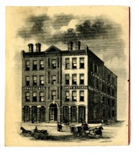
Figure 11. Engraving of the Arbuckle building as it appeared c. 1895. Courtesy of UVM Special Collections.
Figure 12. The Arbuckle factory, as shown on the 1912 Sanborn map. Courtesy of the UVM CDI.
By 1886 Arbuckle & Co. had built a new, more spacious facility.7 The 1894 Sanborn Fire Insurance map shows a four-story brick building, where most of the manufacturing occurred, with smaller wooden storage sheds standing behind it. In the main building, the first floor was used for storage and packing, the second and third for manufacturing candy, and the fourth for storage (see Figures 11 and 12). Like many other manufacturing buildings in the area, it used steam for heat, and initially was lit with oil.8
The company continued successfully in the following decades. For example, Arbuckle & Co. reported an extremely profitable year for 1909: "The business of 1909 was the most profitable that the company has had in many years." 9 Again in 1914 the Burlington Weekly Free Press reported that Arbuckle had "had a very profitable year." 10 Based purely on these reports, the company was doing well. Despite the cheerful assertions of the press, however, the company was forced into involuntary bankruptcy in 1916.11
Figure 13. A pamphlet from the National Paper Tube & Box Co. Courtesy of UVM Special Collections.
After Arbuckle declared bankruptcy, C. L. Woodbury and M. J. Barnes bought the building and leased it to the National Paper Tube and Box Company.12 Its paper products were in high demand to meet the packaging needs of other manufacturing businesses in the area, including a new milk chocolate factory, and a local maple sugar factory (see Figure 13).13 As the Burlington Free Press and Times reported, "From twelve to fifteen thousand pasteboard boxes will…be needed each day…This would mean that the Paper Tube & Box company would have to develop its plant so as to manufacture about three times as many boxes as it can at present…" 14 Additionally, the large volume of orders for wooden boxes guaranteed plenty of business, and the company made plans to install new equipment to meet demand. 15 In 1919 the Paper Tube & Box Company decided to increase its capital to $100,000.16
Later in October 1917, a fire started at a skating rink located at Church and King Street. Many businesses and buildings were affected, and the Tube & Box company lost around $15,000 in the fire, although insurance covered much of the damage.17 The plant was back in operation by November 15th.18 The changes in equipment and the fire did not affect the physical layout of the building, as evidenced by the 1919 Sanborn map.19
The National Paper Tube and Box Company operated in the old Arbuckle building for over twenty years, but by 1938 it too had relocated.20 After its relocation, the building was occupied by a "variety of retail establishments." 21 The 1938 Sanborn map bears that out, showing Allen Realty Company, a furniture warehouse, an upholstery and mattress factory on the second floor, and paper manufacturing on the third.22
The 1942 Sanborn map showed that the building, slightly enlarged with a framed building behind it, continued to be used for paper box manufacturing and upholstery.23 By the 1970s it was occupied by an electrical supplies wholesale company.24 Today, the Arbuckle building holds the Advance Music Center, a retail business (see Figure 10).
Notes (Marble and Granite Works)
1Insurance Maps of Burlington, Vermont (New York: Sanborn Map & Publishing Co., Jan. 1885), Sheet 12. 2 Mary Ann DiSpirito and David Robinson, Images of America: Burlington Volume II (Charleston, SC: Arcadia Publishing, 1999), 55. 3 Ibid. 4 M. H. Landon, "Arbuckle & Co. Account Book," University of Vermont Special Collections, entry #142. Ibid., entry #147. Ibid., entry # 143. Ibid., entry #144. Ibid., entry #145. 5 M. H. Landon, "Arbuckle & Co. Account Book," University of Vermont Special Collections, entry #52. Ibid., entry #54. Ibid., entry #53. 6 M. H. Landon, "Arbuckle & Co. Account Book," University of Vermont Special Collections, entry #35. Ibid., entry #16. Ibid., entry #145. 7 David J. Blow, Historic Guide to Burlington Neighborhoods (Burlington, VT: Chittenden County Historical Society, 1990), 92. 8Insurance Maps of Burlington, Vermont (New York: Sanborn-Perris Map Co., Nov. 1894), Sheet 22. 9 "Good Money In Candy," Burlington Weekly Free Press (Burlington, VT), Jan. 27, 1910. 10 "City News," Burlington Weekly Free Press (Burlington, VT), Jan. 22, 1914. 11 "City News," Burlington Weekly Free Press (Burlington, VT), Jun. 1, 1916. 12 Blow, Historic Guide to Burlington Neighborhoods, 92. 13 "Cans and Boxes Needed," Burlington Weekly Free Press (Burlington, VT), Mar. 29, 1917.; "City News," Burlington Weekly Free Press (Burlington, VT), Apr. 5, 1917. 14 "Cans and Boxes Needed," Burlington Weekly Free Press (Burlington, VT), Mar. 29, 1917. 15 Ibid. 16 "Capital $100,000," Burlington Weekly Free Press (Burlington, VT), Mar. 6, 1919. 17 "Spectacular Blaze on Lower Church ST. Does $50,000 Damage," Burlington Weekly Free Press (Burlington, VT), Oct. 11, 1917; "Box Company Get Location," Burlington Weekly Free Press (Burlington, VT), Oct. 25, 1917. 18 "Box Company Get Location," Burlington Weekly Free Press (Burlington, VT), Oct. 25, 1917. 19Insurance Maps of Burlington, Vermont (New York: Sanborn Map Co., May 1919), Sheet 18. 20 David J. Blow, Historic Guide to Burlington Neighborhoods (Burlington, VT: Chittenden County Historical Society, 1990), 92. 21 Ibid. 22Insurance Maps of Burlington, Vermont (New York: Sanborn Map Co., Jun. 1938), Sheet 23. 23Insurance Maps of Burlington, Vermont (New York: Sanborn Map Co., 1942), Sheet 9. 24Insurance Maps of Burlington, Vermont (New York: Sanborn Map Company, 1978), Sheet 9.
M. & F. C. Dorn Soda Company
The soda plant, which still stands on Pine Street, is one of the more unique stories in the Maple-Kilburn area, both because it was one of the final operating manufacturing plants in the area, and because of its subsequent success story of adaptive reuse (see Figure 14). Although many structures still stand today, the soda plant is unique in that it is still used for small-scale manufacturing, in this case of lights and metal fixtures by Conant Light and Metal.
Figure 14. The Soda Plant, 266 Pine Street. Photograph by Kate Hovanes, Oct. 2013.
M. & F. C. Dorn Bottling was first listed in the Burlington City Directory in 1918.1 As it first appeared in the 1919 Sanborn Fire Insurance map, M & F. C. Dorn Bottlers bears little resemblance to the structure that stands today. The initial building was a small rectangular framed building approximately 75 feet long and 40 feet wide, with exterior iron cladding. The building consistently expanded for each subsequent Sanborn map, with additions to the north side of the building (in the 1926 map); a large stone addition to the front and the back of the building, now approximately 150 feet long (from the 1938 map); and a further addition of two new rooms, approximately fifty feet wide, on the north side that almost brought it to its modern proportions (in the 1942 map).2 Although these additions are a testament to the plant's success with products such as ginger ale, by 1942 the plant switched to producing Coca-Cola, and was renamed the M. & F. C. Dorn Co., Inc. & Coca-Cola Bottling Co. of Burlington.3
Figure 15. The Coca-Cola plant in operation. Photograph by James Detore, 1951. Courtesy of UVM Special Collections.
Figure 16. A worker running the bottling machine. Photograph by James Detore, 1951. Courtesy of UVM Special Collections.
Although historic visual records of the Maple-Kilburn area are limited in scope, a number of photos exist showing the Coca-Cola in operation in the late 1940s and early 1950s. One such photo shows the bottling plant in use, with its mechanized machinery and the classic glass Coke bottles being filled (see Figures 15 and 16). Another, available in Images of America by Mary Ann DiSprito and David Robinson, shows the company's fleet of delivery trucks waiting by the loading docks.5 These images convey an unmistakable sense of pride and well being: the facilities are neat, orderly, and clean, with sleek manufacturing equipment and well-maintained vans. This ethos is hardly surprising when one considers the bottling plant's success over the subsequent twenty-five years.
As Coca-Cola introduced and acquired new brands of soda, the company also produced them. By 1974 it was producing Fresca, Tab, Sprite, Fanta, Canada Dry ginger ale, and Dr. Pepper, as well as Coca-Cola.6 The company continued to operate until 1977, after which it no longer appears in city telephone directories.7
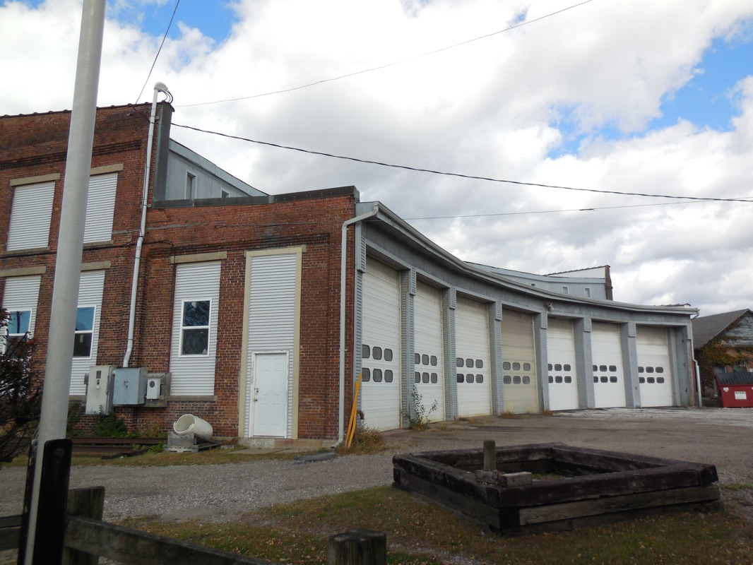
Figure 17. The Conant Metal & Light Company. Photograph by Kate Hovanes, Oct. 2013.
However, its story does not end there. Like many of the historic buildings in the Maple-Kilburn area, the bottling plant was adapted for use as a retail and manufacturing space. The Soda Plant building (as a sign in front labels it) houses businesses ranging from ReSource (a thrift store), to Conant Metal and Light. Conant Metal and Light is particularly interesting, since the company continues the manufacturing tradition of the area, producing custom metal and light fixtures. Until 2008, the company even included a wholesale manufacturing division. Although it is hardly the marble works or the spool and bobbin mill, this adaptive reuse of the building keeps the ethos of manufacturing alive in the area (see Figure 17).8
Notes (Soda Plant)
1Burlington City Directory for 1918 (Burlington, VT: L. P. Waite & Co., 1918), 115. 2Insurance Maps of Burlington, Vermont (New York: Sanborn Map Co., May 1919), Sheet 18; Insurance Maps of Burlington, Vermont (New York: Sanborn Map Co., Apr. 1926), Sheet 23; Insurance Maps of Burlington, Vermont (New York: Sanborn Map Co., Jun. 1938), Sheet 23; Insurance Maps of Burlington, Vermont (New York: Sanborn Map Co., 1942), Sheet 9. 3Manning's Burlington Winooski and Essex Junction Directory (Springfield, MA: H. A. Manning Co, 1940), 186; Ibid., 1942, 404; Insurance Maps of Burlington, Vermont (New York: Sanborn Map Co., 1942), Sheet 9. 4 James Detore, "Coca-Cola Plant," photograph, 1951, UVM Special Collections. 5 Mary Ann DiSpirito and David Robinson, Images of America: Burlington Volume II (Charleston, SC: Arcadia Publishing, 1999), 55. 6Manning's Burlington and South Burlington Winooski and Essex Junction Directory (Greenfield, MA: H. A. Manning Company, 1974), 214. 7Manning's Burlington and South Burlington Winooski and Essex Junction Directory (Greenfield, MA: H. A. Manning Company, 1977), 203. 8 "The History of Conant Metal & Light," Conant Metal & Light, accessed Oct. 18, 2013, http://www.conantmetalandlight.com/about/history/.
Rutland Railroad Round House
No discussion about manufacturing in Burlington could be complete without mention of the railroad. In the case of this report, the Rutland Railroad Roundhouse, a significant landmark belonging to the Rutland Railroad, stands just north of Kilburn Street on the far side of Battery Street. Since it closely relates to manufacturing, but was not itself a factory, this report will not deal extensively with the Roundhouse, present in the area since before 1869.1
Figure 18. (Top) The Rutland Railroad Roundhouse, as it stands today. Photograph by Kate Hovanes, Oct. 2013.
Figure 19. (Bottom) Another view of the Rutland Railroad Roundhouse. Photograph by Kate Hovanes, Oct. 2013.
That the Rutland Railroad played a vital role for many of the manufacturing companies in the Maple-Kilburn area is undisputed. In operation since 1849, when it first opened as the Vermont Central and Rutland and Burlington Railroad, a number of sources make specific reference to the convenience of the railroad and its use in the transport of raw materials.2 One excellent example is a Burlington Free Press article from 1879. Although the article dealt with the recently established marble works, it noted that
The quarries of white and clouded marbles…begin just south of us and extend for sixty miles or more, many of them in near proximity to the Rutland railroad, affording facilities for carrying the rough blocks where they can be best worked and marketed.3
The article makes a very explicit connection between the Rutland railroad and the marble factories. Considering the amount of marble being worked by the Burlington Manufacturing Company and Goodell & Co., the ease of transport with the railroads made the volume of production possible.4
Another publication published in 1887 also makes note of the impact of transportation on manufacturing:
The Transportation Facilities sic of Burlington are unsurpassed. It has excellent railroad connections and the lake and canals afford water communication…ensuring perpetually cheap…and competing freight and travel rates… 5
The cheap transportation that the railroads along the waterfront provided were essential to companies, since low rates meant products could be sold for less, or with a greater profit margin. The railroad offshoots that connected many companies in the Maple-Kilburn area to the Rutland railroad were a testament to its importance.6
The Roundhouse itself underwent considerable changes throughout its history, many of them due to a series of disasters that befell the building. The first of a long string of accidents reported by the Burlington Weekly Free Press, in late 1905 the Roundhouse was partially destroyed by fire. As the press reported, the building was likely to be replaced since only two engines could be stored in it, and the others had to be kept outside.7 The replacement did not happen for at least a year, however, and the inaction caused further damage to the building in October of 1906, when a wall, approximately 20 feet high by 30 feet long and weakened by the fire, fell due to strong winds. No one was injured in the accident.8
In 1909 another fire destroyed the rebuilt roundhouse, although it was less clear whether the blaze was an accident. The fire was certainly far more severe than the earlier 1905 accident; it caused approximately $100,000 in damage, and destroyed five train engines. The construction of the building contributed to the damage. As the paper phrased it, "…the building itself…was a wooden structure and…burned as tinder when the fire was once under way." Although railroad employees discovered the fire, it was too intense to be extinguished. When addressing the cause of the conflagration, the Free Press went so far as to ominously speculate that "It is not known how the blaze started and no theory of an accidental origin has been advanced. It is surrounded by so much mystery that many are of the opinion that it was of an incendiary nature as no other theory seems to fit what is known of the circumstances." Although no later articles back up the assertion of sabotage, the roundhouse was rebuilt in brick rather than wood, presumably to prevent similar disasters in the future.9
As the city grew, other changes were made to the roundhouse. In 1917, the city considered putting a permanent sewer under it, while in 1918 the Rutland Railroad built and entirely new roundhouse to replace the old one. The new building was more than twice as large as the old building, and the improvements included new tracks and additional land development. The Burlington Free Press even went so far as to proclaim that with the changes, "an old-timer would have hard work getting his bearings around" the Maple Street waterfront.10
The Rutland Railroad continued to operate until 1962, at which point it was shut down because of decreasing profits.11 However, limited operations resumed in 1964 after a new company, Vermont Railway, took over Rutland's old routes.12 The roundhouse is still in use as the railroad's main maintenance shop today, making it the only structure in this report to still be used for its original purpose (see Figures 18 and 19).13
Notes (Roundhouse)
1Sanborn Insurance Map of Burlington, Vermont (D. A. Smalley, 1869), Sheet 6. 2 Charles E. Allen, Burlington, Vermont Statistics, 1763 to 1893 (Burlington, VT: Free Press Association, 1893), 9. 3 "The Industry of Burlington: The Marble Business—J. W. Goodell and Company," Burlington Free Press (Burlington, VT), Jun. 27, 1879 4 Ibid. 5Burlington, Vermont: Its Advantages as a Manufacturing and Mercantile Center (Burlington, VT: Free Press Association, 1887), 5. 6Insurance Maps of Burlington, Vermont (New York: Sanborn Map Co., Oct. 1912), Sheet 28. 7 "City News," Burlington Weekly Free Press (Burlington, VT), Nov. 9, 1905. 8 "Wall Blown Down," Burlington Weekly Free Press (Burlington, VT), Oct. 11, 1906. 9 "Five Locomotives Were Destroyed," Burlington Weekly Free Press (Burlington, VT) Dec. 30, 1909; Insurance Maps of Burlington, Vermont (New York: Sanborn Map Co., Oct. 1912), Sheet 28. 10 "Addition to Ira Allen School," Burlington Weekly Free Press (Burlington, VT), Jul. 5, 1917; "Building Record of Year," Burlington Weekly Free Press (Burlington, VT), Jan. 3, 1918. 11The Rutland Railroad, p. 208 Jim Shaughnessy, The Rutland Road (Syracuse, NY: Syracuse University Press, 1997), accessed Oct. 25, 2013, books.google.com/books?id=U88x2eDEBFUC&dq=rutland+rail+road+roundhouse+burlington&source=gbs_navlinks_s, 208. 12 Ibid., 208. 13 Ibid., 210.
Wharf Lane Apartments (Blodgett, General Electric)
The Blodgett Company is an important oven manufacturing firm that is still in operation. Although it is currently centered in the Lakeside district, the company also utilized many locations throughout the Burlington area, one of which was located on the south side of Maple Street in a building now known as the Wharf Lane Apartments.
Figure 20. The Wharf Lane Apartment building, as it stands today. This building at various points housed the a Blogett oven mill and a General Electric wire assembly plant. Photograph by Kate Hovanes, Oct. 2013.
The building was first built by the G. S. Blogett Company in 1925 as an oven manufacturing plant. According to the Historic Guide to Burlington Neighborhoods, the structure was designed by Frank L. Austin, a well-known architect in Burlington.1 As it appeared in the 1926 Sanborn map, the G. S. Blodgett Company Inc. Wholesale Plumbing Supplies building was a three story brick building, approximately 75 feet wide and 125 feet long, facing north towards downtown.2 By 1942 Blodgett had expanded its operations in the Maple Street area. The initial building had become the company's Oven Department, and the hardware and plumbing supplies division had moved to a new property on the west side of South Champlain Street. The new property, a framed building with iron cladding, was located next to the Champlain Valley Fruit Company.3 Although the Blogett Company's use of the building is important to note, it does not represent company's primary manufacturing location.
The Blogett Company remained in the building for a total of 27 years. In 1952, however, General Electric purchased the oven department's building for use as a wire assembly plant, for which it was used until GE moved its manufacturing in 1978.4
Although there are disparities in information provided by various resources, it is possible to roughly trace what happened to the building after GE's move. Sources agree that the building was sold to Pizzagalli Realty between 1978 and 1980. It is possible that the dates reflects merely a time of flux between 1978 and 1980, or one date may simply be incorrect. Regardless, it is certain that the building was subsequently converted to low-income housing, a purpose for which it has been used ever since (see Figure 20).5
Notes (Wharf Lane)
1 David J. Blow, Historic Guide to Burlington Neighborhoods (Burlington, VT: Chittenden County Historical Society, 1990), 92-93. 2Insurance Maps of Burlington, Vermont (New York: Sanborn Map Co., Apr. 1926), Sheet 21. 3Insurance Maps of Burlington, Vermont (New York: Sanborn Map Co., Apr. 1926), Sheet 23; Insurance Maps of Burlington, Vermont (New York: Sanborn Map Co., 1942), Sheet 9; David J. Blow, Historic Guide to Burlington Neighborhoods (Burlington, VT: Chittenden County Historical Society, 1990), 92-93. More information on the Blogett Company can be found in Kyle Obenauer's report on the company. 4 David J. Blow, Historic Guide to Burlington Neighborhoods (Burlington, VT: Chittenden County Historical Society, 1990), 93. 5 Blow, Historic Guide, 93; "57 Maple St," City of Burlington Property Search, accessed Oct. 10, 2013, http://property.burlingtonvt.gov/PropertyDetails.aspx?a=7194; Kevin J. Kelley, "Against the Odds, a Burlington Housing Development Will Remain Affordable — Forever," Seven Days, Aug. 8, 2012, http://www.7dvt.com/2012against-odds-burlington-housing-development-will-remain-affordable-forever. There is disparity between the events reported in the Historic Guide to Burlington Neighborhoods, which provides much information on the structure, and the City of Burlington Property Database website. These disparities range from dates of sale to the actual name of the building, which is listed as the "Maple Street Apartments" in the Historic Guide and as the "Wharf Lane Apartments" on the planning website.
Loose-Wiles Biscuit Co.
One of a number of a number of smaller businesses and warehouses that began business in the Maple-Kilburn area starting in the 1910s and 20s, the Loose-Wiles Biscuit Company first appears on the 1926 Sanborn map. A partially iron-clad with steel framing, the original building was a small two story structure set back from the street.1 It also used the former marble sawing and polishing building of the Burlington Manufacturing plant as a biscuit storehouse.2 Because the Loose-Wiles Biscuit Company Wholesale was not a manufacturing location, this report will not focus heavily on it.
Figure 21. The area on South Champlain in which the Loose-Wiles Biscuit Company stood. The original building no longer stands. Photograph by Kate Hovanes, Oct. 2013.
The Loose-Wiles Biscuit Co. was a national brand that, around the time of warehouse's opening, was the second biggest biscuit company in the nation.3 It is difficult to tell whether the structure the company used on South Champlain Street was intended for manufacturing biscuits or simply for storage. A report on the Loose-Wiles Biscuit Company from the Wall Street Journal in 1928 suggests that it was not factory. The article listed all the manufacturing locations, including a "small" plant in Chelsea, MA. The fact that Burlington did not make the list, when even a minor factory did, suggests that the building on South Champlain may have been used for storage or as a distribution center.4
The Loose-Wiles Biscuit Company remained at its location for a number of years, but by the 1942 Sanborn map the company was no longer listed.5 During the 1970s they were used for storage of paper products (in the old Burlington Manufacturing Company building), and to build new buildings for cold storage by the Champlain Valley Fruit Company (on South Champlain).6 The structures it occupied currently house a variety of retail establishments, as well as a number of artists' studios in the old biscuit storehouse building (see Figure 21).
Notes (Loose-Wiles Biscuit Company)
1Insurance Maps of Burlington, Vermont (New York: Sanborn Map Co., Apr. 1926), Sheet 23. 2Insurance Maps of Burlington, Vermont (New York: Sanborn Map Co., Jun. 1938), Sheet 23. 3 "Loose Wiles has a Good Year." Wall Street Journal (1923 - Current File), Nov 09, 1925.
http://search.proquest.com/docview/130289890?accountid=14679. 4 Special from Boston, News Bureau. 1928. "Loose-Wiles Biscuit Sales Increased 5%." Wall Street Journal (1923 - Current File), Aug 28, 3. http://search.proquest.com/docview/130570463?accountid=14679. 5Insurance Maps of Burlington, Vermont (New York: Sanborn Map Co., 1942), Sheet 9. 6Insurance Maps of Burlington, Vermont (New York: Sanborn Map Company, 1978), Sheet 9.
National Biscuit Company
The National Biscuit Company, also known as Nabisco, is one of the nation's best known cookie companies, controlling brands including Nilla wafers, Oreos, and Chips Ahoy! cookies.1 Although it first appears in the Maple-Kilburn area in the 1926 Sanborn map, the National Biscuit Company was present in Burlington even earlier—the 1919 Sanborn map shows it located at 198 College Street.2
Figure 22. The old National Biscuit Company building, previously part of the Burlington Manufacturing Company's marble works. It now houses artist's studios. Photograph by Kate Hovanes, Oct. 2013.
The National Biscuit Company occupied one of the buildings abandoned by the Burlington Manufacturing Company, a two-story brick structure on the east side of South Champlain Street. Around the time Nabisco occupied its new location on South Champlain it was ranked as the largest biscuit producer in the nation.3 Since the building on the Sanborn maps is listed as "wholesale cookies," it is difficult to determine whether the building was meant tor manufacturing or just for storage. What is clear, however, is that the company was one of the longer-lasting residents of the area. It appears in the Sanborn Fire Insurance maps through 1942, but by 1978 its building was occupied by a news agency.4 The building, currently located at 266 S. Champlain Street, currently houses artists studios and gallery space (see Figure 22).
Notes (National Biscuit Company)
1 "Brands," SnackWorks, accessed Oct. 22, 2013, http://www.snackworks.com/products.aspx. 2Insurance Maps of Burlington, Vermont (New York: Sanborn Map Co., May 1919), Sheet 16. 3 "National Milling." Wall Street Journal (1923 - Current File), Jan 24, 1928.
http://search.proquest.com/docview/130624189?accountid=14679. 4Insurance Maps of Burlington, Vermont (New York: Sanborn Map Co., 1942), Sheet 9; 1978 Sanborn #9.
D. W. Robinson Planing Mill
First listed in the 1885 Sanborn Fire Insurance Map, the D. W. Robinson Planing Mill, at one point a spool and bobbin manufactory, stood just south of the Burlington Manufacturing Company's marble and granite mill.1 Although there is little evidence to point to its existence today, the mill comprised of a cluster of one- to two-story buildings that included framed lumber sheds and the planing mill, a brick dry house and storage for coal and wood shavings.2
An interesting fact arises from historical sources about the planing mill. Although the spool and bobbin mill in the Maple-Kilburn area that people most readily associate with the Maple-Kilburn area was on South Champlain, a number of documents mention the presence of a bobbin mill in the area up to twenty years prior to the incorporation of the Vermont Spool and Bobbin Factory. The bobbin mill in question was actually the planing mill, which appears to have operated as a spool and bobbin factory prior to its use for planing wood—in 1885 the Sanborn map lists a "Spool and Bobbin Manufactury," and four years later the 1889 edition lists the same buildings as a planing mill.3 The Annual Report of the City of Burlington for 1885 also mentions a fire on February 7th in a spool and bobbin mill belonging to L. Barnes (the owner of the mill in question) that incurred $13,000 in damage.4 Although there are few historic sources on the bobbin mill, it is certainly important to differentiate it from the later business to the north.
Figure 23. The D. W. Robinson Planing Mill, from the 1894 Sanborn map. Courtesy of UVM Special Collections.
As the Sanborn maps noted, the Planing Mill changed ownership, and presumably manufacturing production, between 1889 and 1894. Although Lawrence Barnes still owned the property, it had shifted from spool and bobbin production to use as a planing mill.5 When the new company appeared in the 1894, it may have been related to the Skillings, Whitney and Barnes Lumber Company, in operation south of Kilburn Street.6 However, by 1912 it was listed as part of the Robinson-Edwards Lumber Yard, which had superseded the previous lumber yard, and had been renamed the D. W. Robinson Planing Mill (see Figure 23).7
The real significance of the planing mill within the bounds of this report, however, is in its relation to the other manufacturing companies. A number of factories in the area were powered in part by wood shavings—most notable, perhaps, were the marble works just to the north—making the by-products of the woodworking at locations like the planing mill were vital to other manufacturing work.8
Notes (D. W. Robinson Planing Mill)
1Insurance Maps of Burlington, Vermont (New York: Sanborn Map & Publishing Co., Jan. 1885), Sheet 12. 2Insurance Maps of Burlington, Vermont (New York: Sanborn-Perris Map Co., Nov. 1894), Sheet 22. 31885 Insurance Map of Burlington, Vermont, Sheet 12; Insurance Maps of Burlington, Vermont (New York: Sanborn Map & Publishing Co., Jun. 1889), Sheet 25. 4Annual Report of the City of Burlington, Vermont (Burlington, VT: R. S. Styles, 1886), 37. 51889 Insurance Map of Burlington, Vermont, Sheet 25; Insurance Maps of Burlington, Vermont (New York: Sanborn-Perris Map Co., Nov. 1894), Sheet 22. 61894 Insurance Map of Burlington, Vermont, Sheet 22. 7Insurance Maps of Burlington, Vermont (New York: Sanborn Map Co., Oct. 1912), Sheet 22. For further information on the lumber yards please see the Karyn Norwood's work on the area south of Kilburn Street. 8 Ibid.; Insurance Maps of Burlington, Vermont (New York: Sanborn-Perris Map Co., Jan. 1900), Sheet 25.
Ferguson Brother's Ice House
Since it was storage and distribution facility, not a factory, this report will only briefly touch on the Ferguson Brother's Ice House. The ice house was located between Pine Street and St. Paul Street near Maple Street, and first appeared in the 1889 Sanborn Fire Insurance map.1Figure 24. Ferguson Bros. Ice House, from the 1900 Sanborn map. Courtesy of UVM Special Collections.
Two and a half stories tall, with wood frame construction, approximately 125 feet long by 50 feet wide, the building would have dominated its surroundings at the time.2 The facility was used for the storage and distribution of ice, presumably obtained from Lake Champlain as with other similar facilities.3 By 1912, however, the company was no longer listed on the Sanborn map (see Figure 24).4
Notes (Ferguson Brother's Ice House)
1Insurance Maps of Burlington, Vermont (New York: Sanborn Map & Publishing Co., Jun. 1889), Sheet 25. 2Insurance Maps of Burlington, Vermont (New York: Sanborn-Perris Map Co., Nov. 1894), Sheet 22. 3 "Natural Ice News and Notes," Cold Storage and Ice Trade Journal 41 (1911): 93, accessed Oct. 20, 2013, http://books.google.com/books?id=V-MyAQAAMAAJ&dq=ice+harvest+champlain+ice+house+vermont&source=gbs_navlinks_s. 4Insurance Maps of Burlington, Vermont (New York: Sanborn Map Co., Oct. 1912), Sheet 22.
Burlington Beef Co.
The Burlington Beef Company is another business that does not strictly represent a "manufacturing" plant but which still bears mentioning because of its relation to the beef industry and its location in the Maple-Kilburn area. Originally built in 1892, the Burlington Beef Company warehouse stood on the southeastern corner of Maple and South Battery Street.1 At the time of its construction, the new cooler in the building was the largest, and most expensive, in Vermont.2Figure 25. The Burlington Beef Company warehouse on the corner of Maple and Battery St, from the 1894 Sanborn Map. Courtesy of UVM Special Collections.
Its move from its previous location near the docks was necessary because the previous facilities could not cope with the increasing volume of merchandise.3 The 1894 Sanborn map showed the new building, described as the "Dressed Beef Warehouse," as a two-story, wood-framed structure approximately 75 by 30 feet (see Figure 25).4
The Burlington Beef Company continued to operate its warehouse there until 1906, and by 1912 Swift & Co. Cold Storage had taken over its facilities.5 After, it continued to be used for storage until at least 1978.6
Notes (Burlington Beef Co.)
1 "Vicinity Matters," Burlington Free Press (Burlington, VT), Mar. 17, 1892; Insurance Maps of Burlington, Vermont (New York: Sanborn-Perris Map Co., Nov. 1894), Sheet 22. 2 "Vicinity Matters," Burlington Free Press (Burlington, VT), Jul. 21, 1892. 3 "Vicinity Matters," Burlington Free Press (Burlington, VT), Mar. 17, 1892. 4Insurance Maps of Burlington, Vermont (New York: Sanborn-Perris Map Co., Nov. 1894), Sheet 22. 5Burlington City and Winooski Directory for 1906 (Burlington, VT: L. P. Waite & Co., 1906) 80; Insurance Maps of Burlington, Vermont (New York: Sanborn Map Co., Oct. 1912), Sheet 22. 6Insurance Maps of Burlington, Vermont (New York: Sanborn Map Company, 1978), Sheet 9.
E. F. Moore Manufactory of Concrete Building Blocks
The Manufactory of Concrete Building Blocks was the shortest-lived manufacturing company in the Maple-Kilburn area. It was listed on just one Sanborn map, the 1906 edition, making it difficult to gauge how long it was in operation and to find information on the company itself.
Figure 26. The E. F. Moore Manufactory of Concrete Building Blocks (on the left side of image), as it stood near the Vermont Spool and Bobbin Co. mill, from the 1906 Sanborn map. Courtesy of UVM Special Collections.
The 1906 map placed the manufactory in the building previously used by the Burlington Manufacturing Company for polishing marble (see Figure 26).1 Its primary significance was that it was the company that provided the concrete blocks for the Vermont Spool and Bobbin Manufactury.2 At the time, the use of concrete blocks was an emerging technology, and the bobbin mill was the first of its kind in the area.
Despite its strong initial start with the bobbin mill, the concrete block manufactory did not appear in the subsequent 1912 Sanborn map.3
Notes (E. F. Moore Manufactory)
1Insurance Maps of Burlington, Vermont (New York: Sanborn Map Co., Mar. 1906), Sheet 29. 2 "Industry Exempted," Burlington Weekly Free Press (Burlington, VT), Mar. 30, 1905. 3Insurance Maps of Burlington, Vermont (New York: Sanborn Map Co., Oct. 1912), Sheet 22.
Manufacturer of Plaster & Phosphates
This report will not deal extensively with the plaster and phosphate mill which operated on the waterfront at the end of Maple Street, as the structure that housed it is no longer standing. The mill first appears on the 1885 Sanborn map—a small brick structure with a two-story framed wooden storage shed, owned by Henry Loomis and leased by Elias Lyman.1 The company was originally run as a partnership between F. H. Wilkins and Elias Lyman, a well-known Burlington businessman. Lyman bought out Wilkins in 1893 to organize the Elias Lyman Coal Co., which also controlled the plaster mill.2 The plaster mill ceased to appear on Sanborn maps by 1900.3
Notes (Plaster & Phosphates)
1Insurance Maps of Burlington, Vermont (New York: Sanborn Map & Publishing Co., Jan. 1885), Sheet 12. 2 "Elias Lyman Dies In His 74th Year," Burlington Free Press and Times (Burlington, VT), Apr. 2, 1923; Burlington City and Winooski Directory for 1906 (Burlington, VT: L. P. Waite & Co., 1905), back cover. 3Insurance Maps of Burlington, Vermont (New York: Sanborn-Perris Map Co., Jan. 1900), Sheet 24.
Brewery and Malt House
W. L. Stone's Brewery and Malt House is among the buildings of which little to no trace remains. Standing on the west side of South Champlain Street, south of Maple Street, it first appears on the 1869 Sanborn map.1 The brewery was housed in two long, two-story rectangular wood-framed buildings.2 Even in the 1885 Sanborn map, however, the brewery's troubles are apparent—as the map helpfully notes, there was "No brewing at present," and one building is tersely labeled "Not used." 3 By 1889 the brewery was no longer listed on the maps.4
Notes (Brewery and Malt House)
1Sanborn Insurance Map of Burlington, Vermont (D. A. Smalley, 1869), Sheet 6. 2Insurance Maps of Burlington, Vermont (New York: Sanborn Map & Publishing Co., Jan. 1885), Sheet 12. 3Insurance Maps of Burlington, Vermont (New York: Sanborn Map & Publishing Co., Jan. 1885), Sheet 12. 4Insurance Maps of Burlington, Vermont (New York: Sanborn Map & Publishing Co., Jun. 1889), Sheet 25.