Vermont Barn Census
Chittenden County Student Research Project - 2010
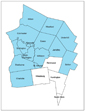
Burlington and South Burlington Censuses
...
Burlington and South Burlington

|
Vermont Barn CensusChittenden County Student Research Project - 2010 |
|
Burlington and South Burlington Censuses ... |
|
|
"No city or village in the New England States surpasses Burlington in beauty of location. The hill upon whose gentle slope it is situated rises gradually back from the lake front until its highest point is reached one mile from the shore... Upon the highest point, College Hill, is situated the University, of Vermont, from whose observatory a view may be obtained of the surrounding beautiful scenery—scenery that few, we take it, will claim to have seen excelled. On the east rise the Green Mountains, Mansfield and Camel's Hump in full view from base to summit, with a fine sweep of open country between. On the north is the valley of the Winooski, and of Lake Champlain stretching north to St. Albans Bay, while on the south the hill sinks away and leaves in sight Shelburne Bay with its picturesque shores, land-locked, and apparently a lake rather than a bay, and with everything that is beautiful of hill and dale, woodland and meadow, distant water and mountains sinking into the horizon, for accompaniments of the scene... Immediately below, from the front of the college green, extend the broad well-kept streets, leading to the lake front, where acres upon acres of land have been made by filling in along the shore, and the whole now covered by immense lumber yards, large mills, and extensive wharfing, proclaiming that enterprise, commerce and manufacture are marching onward, hand in hand." - Hamilton Child, “City of Burlington,” Gazetteer and Business Directory of Chittenden County, for 1882-1883 |
|
|
|
Funding support for the Vermont Barn Census project has been provided in part by a Preserve America grant through the National Park Service to the State of Vermont Division for Historic Preservation.