Photographer: Louis L. McAllister
Date: August 10, 1929
Description:
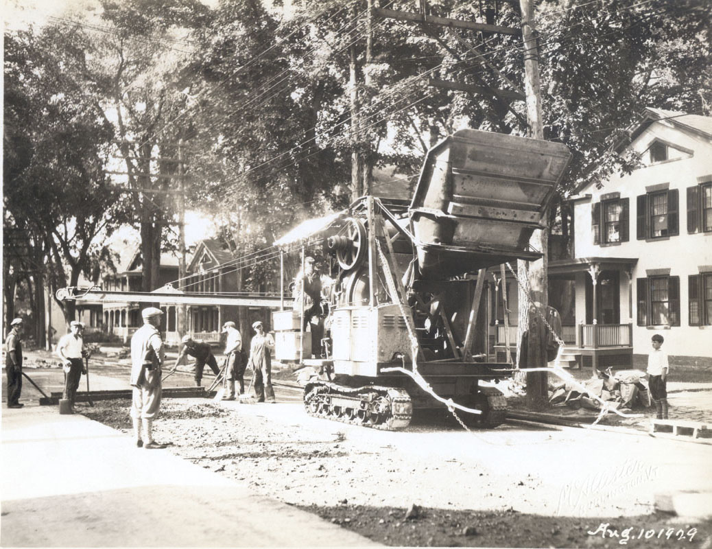
In the foreground there is a large paving truck in the center of the photograph; it is so large that it blocks two houses behind it. There are six men holding shovels and brooms laying down the mixture of the new road. There is no evidence left of the track; the streetcar stopped running on August 4, 1929, only six days before this photo was taken. The tracks had to be removed for the increased use of buses and cars.(1) According to the 1929 Annual Report, this section of North Winooski Avenue had been built in asphalt that year; approximately 2910 square yards were covered, and the cost was $10, 544.20. The street commissioner noted that excavating the track with a power shovel was a great time saver, which allowed them to come under budget.(2) The houses on this section of the street are predominately Greek revival. The house viewable in this photograph is number 103. Number 103 is the house on the right side of the photograph. It is an L plan Greek revival house that was built circa 1850’s, and the 1853 map shows this side of the street with many buildings, including ones comparable to where this house is.(3) The projecting portion of the L-shaped house is a gable front and has three bays with a covered entrance on the left. It is brick masonry construction and has six-over-one windows with masonry lintels and shutters surrounding. By 1889, there is a barn on the side. In 1906 the property line is different; the barn is gone perhaps because of the property line, and an addition is constructed on the back, or the barn was moved, which is more likely because in 1926 the addition is listed as a shed.(4) At the time this photograph was taken, this was a two-family house; one part belonged to Eugene Styles, who was an owner of a drug store at the Masonic Temple on Church Street and the other was Albert Humphrey.(5) The street is lined with elm trees, and since this picture was taken in August, the canopy greatly shadows the road.
(1) Little, Charles O. “The History of Vermont Transit.” http://www.vermonttransit.com/history.html
(2) 1929 City Directory.
(3) 1853 Map
(4) Sanborn Maps 1889-1926
(5) 1929 City Directory
|
Photographer: Rebecca McNamara
Date: September 21, 2005
UTM Coordinates: 18T 0642238 4927154
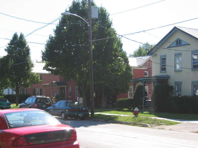
Standing in front of 108 North Winooski Avenue looking southwest
Description:
Walking down the street in 2005, the front 103 North Winooski Avenue looks very much the same. However, a few changes occurred over the years. In 1942, the hyphen between the house and the shed had been knocked down, and the entire house was converted into apartments.(1) The shutters have been removed from the exterior. The house remains as apartments today, and is in fairly good condition. The large elms have since disappeared from 1929, but a few full trees have grown in their place.
(1) 1942 Sanborn
|