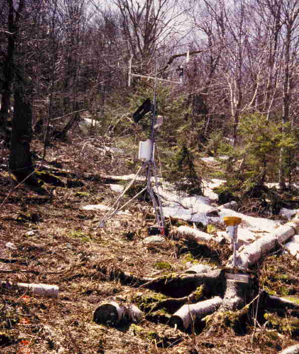
In September 1996, a meteorological station became operational on Mt. Mansfield, just east of the CCC road, in the Mt. Mansfield State Park, at 2900' (884 m) in elevation. Funding for this station was provided through a cooperative agreement with the US Forest Service Northeastern Forest Experiment Station and VMC in response to an expressed need for mid-elevation meteorological data. This station provides basic meteorological variables including wind speed and direction, air temperature, relative humidity, total solar irradiance, photosynthetically active radiation (PAR), and precipitation during nonfreezing months. These data will be valuable to research projects located on mid-elevation slopes of Mt. Mansfield.
Data are also automatically downloaded via radio frequency (RF) modems from the Campbell CR10X datalogger to a base station in the Rubenstein Ecosystem Science Laboratory at UVM. Downloading of data occurs daily with (96) 15 minute average records collected and stored during each downloading cycle. Archived meteorological data from September 1996 to present are available online at the VMC web site.
| |