Summary of Neighborhood Simulation and Visualization Techniques
Thomas D. Visser
Historic Preservation Program,
University of Vermont, Burlington, VT
July 1990
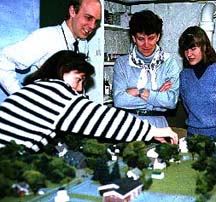
Research by the University of Vermont's Historic Preservation Program under the direction of Chester Liebs and Thomas Visser has explored how three-dimensional scale models can be used to simulate various types of physical changes to neighborhoods. Through the use of "Visual Laboratory" simulations the impact of the loss of historic buildings or the construction of proposed developments can be readily visualized and options can be explored. This ability to preview the future could assist those reviewing the impact of proposed projects on existing neighborhoods.
Recognizing that many people have difficulties translating plot plans and elevations into clear images of the impact of proposed projects, such visualization techniques as artist's renderings have traditionally been used. These however can often emphasize the glamour of the proposal through clever manipulations of viewpoints and scenery, while the true impact on the character of the existing area may be difficult to ascertain.
Models of proposed buildings can effectively translate plans and elevations into three dimensions, but all too often project models are constructed solely of the new building and the relationship with the pre-existing context of the area affected by the proposal is excluded or only minimally rendered. Whether viewed directly or photographed, three-dimensional simulations can be highly realistic, but the cost of producing scale models of streetscapes, waterfronts, and villages can stand as a limitation. Model making is very labor intensive. Firms specialize in this work, producing models and images for architects and developers, and it is not unusual for a high-quality simulated view of a proposed building, produced from a detailed model, photographically superimposed into an existing landscape, to cost several thousand dollars. For multiple views on a forty acre neighborhood, the cost could be many times that amount.
A main goal of the research which professors Chester Liebs and Thomas Visser conducted at the UVM Historic Preservation Program's Visual Laboratory was to develop affordable techniques for producing accurate, objective environmental simulations of neighborhoods, especially to help planners, review commissions, citizens, and designers assess the impact of changes. Largely funded by a Design Arts grant from the National Endowment for the Arts, the project has also received support from the Town of Williston, Vermont, and the Williston Historical Society.
Work on developing environmental simulation techniques to assist preservation planning has been proceeding for over a decade at the University of Vermont and other institutions. A class of UVM Historic Preservation Program graduate students under the direction Professor Liebs examined the potential of such simulations in 1973. Meanwhile at the University of California, Berkeley, simulation techniques for urban planning have been developed through the Berkeley Environmental Simulation Laboratory under the direction of the late Prof. Donald Appleyard, Prof. Karl Mellander, and Prof. Peter Bosselman. The University of Vermont Historic Preservation Program is indebted to Peter Bosselman and his graduate students, Richard Sinkoff and Kevin Gilson, for their assistance on this project. Mr. Sinkoff served as an intern during the summer of 1987.
The simulation techniques were further refined for historic preservation applications by Liebs and Visser and a class of Historic Preservation Program graduate students at UVM. Liebs served as interpretive director, while Visser served as technical director for several pilot projects. An important goal was to develop simulation techniques with relatively inexpensive and common equipment.
The purpose of this article is to review this research and the techniques developed so that others may take advantage of this potentially powerful tool and further explore its applications, especially for the preservation of historic neighborhoods.
First it must be recognized that these modeling techniques are attempting to produce an illusion of reality. The very process of creating such illusions offers insights into how actual landscapes are composed and perceived, and what visual clues trigger the recognition of the specific or general qualities of a place. That is, one goal of the research is to identify those elements of a landscape which give it a recognizable character.
 The UVM models have included the following elements:
These are the variables, the visual clues which were orchestrated to depict "Vermont" landscapes. Another goal of the research is to show how these elements can be manipulated to produce life-like landscape simulations. It must be recognized though, that the techniques used to produce these illusions of reality could also be used to cast a biased light. Care must also be taken not to let the ease of alteration of landscapes encourage change. It is hoped that the process of simulating the impact of landscape changes through the manipulation of these simulations as test models will provide the opportunity to encourage debate and analysis of various planning and preservation options.