Proctor Place |
June 13, 1935; Louis L. McAllister |
October 26, 2006; Caitlin Meives |
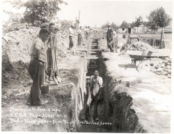
| In this 1935 image, one sees a number of workmen constructing a portion of the sewer that was to run from Wright Avenue. McAllister took this image from the south end of Proctor Place, looking north toward Wright Avenue and Lake Champlain. The gable roofed house visible in the distance, to the right of the sewer, is the back of a house between Wright Avenue and Harrison Avenue. The garages on the right side of the image sit behind houses on Central Avenue.[19]
[19] (author unknown), Photo Caption, Louis L. McAllister |
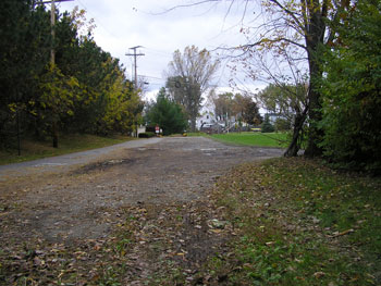
The houses visible to the north and east in the McAllister image still stand today. Though not visible from the point of view in the above image, the area just west of Proctor Place has seen significant change since 1935. Today there is a development of lakefront condominiums or apartments called Harbor Watch. Proctor Place itself never became a road; it continues south from this point to a driveway and bikepath. The northern end of Proctor Place terminates at Harrison Avenue, clearly visible in the above image. |
Historic Burlington Project Depression Era Streetscapes: Old North End | Burlington 1890 | Burlington 1877 | Burlington 1869 | Burlington 1853 | Burlington 1830 Produced by University of Vermont Historic Preservation Program graduate students in HP 206 Researching Historic Structures and Sites - Prof. Thomas Visser - in collaboration with UVM Landscape Change Program Historic images courtesy of University of Vermont Library Special Collections, Louis L. McAllister Photograph Collection |