
Main Street: Northwest to University Place UTM: 180643238E; 4926368N |
 Louis L. McAllister c. 1933 |
 Sarah L. Graulty October 30, 2006 |
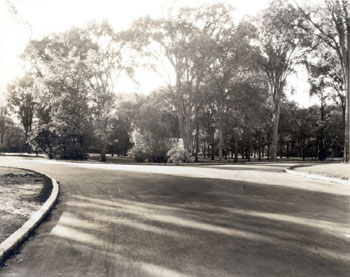
| This photograph of University Place from Main Street, taken by McAllister circa 1933, shows no obvious buildings, but it is nevertheless an interesting record of change. The landscape, viewed looking to the northwest from near the Burlington Reservoir's Pump House, is filled with tall, lush elm trees creating a canopy over the University Green. |
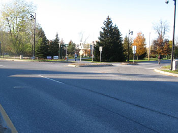
This contemporary image of University Place leaves a different impression than it did in 1933. Without the canopy of tall trees, the expanse conveys the sense of a field rather than a forest. Also, the widened street has straightened out previous road's rounded curves, which lent it a slower, meandering feel. |
Historic Burlington Project Depression Era Streetscapes: Old North End | Burlington 1890 | Burlington 1877 | Burlington 1869 | Burlington 1853 | Burlington 1830 Produced by University of Vermont Historic Preservation Program graduate students in HP 206 Researching Historic Structures and Sites - Prof. Thomas Visser - in collaboration with UVM Landscape Change Program Historic images courtesy of University of Vermont Library Special Collections, Louis L. McAllister Photograph Collection |