
|
Shelburne Road -- From Crawl to Sprawl |
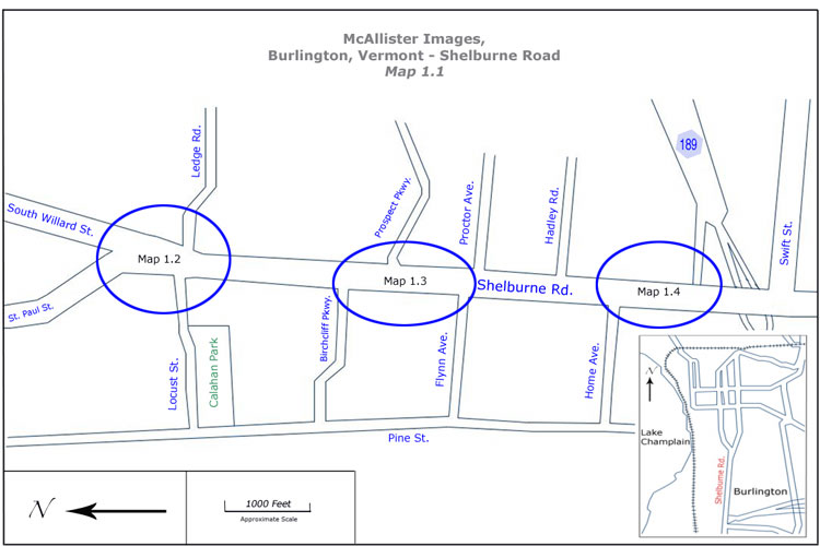 |
To view Detail Maps with locations of McAllister photographs, click on blue circles. |
During the 1920's, 30's and 40's, photographer Louis McAllister took a series of photographs for the Burlington Streets Department. Their original purpose was to document road construction projects, however they also captured a slice of the city's history. Comparisons of these photographs to current images provide historians with a powerful tool for researching the evolution of Burlington. The images accessible from this page document the changing cityscape of Shelburne Road. Now a major north/south artery into Burlington's downtown, it has undergone many changes, but a closer look reveals that there are still links to the past, and the Burlington McAllister knew. Shelburne Road extends south from the rotary intersection with Ledge Road, South Willard Street, Shelburne Street and Locust Street to the South Burlington city line and continues south through South Burlington to Shelburne. North of the rotary intersection with Ledge Road and South Willard and Locust Streets, Shelburne Road becomes Shelburne Street. Caitlin Corkins Back to Depression Era Streetscapes, Burlington: Vermont South of Pearl Street & Colchester Avenue |
Historic Burlington Project Depression Era Streetscapes: Old North End | Burlington 1890 | Burlington 1877 | Burlington 1869 | Burlington 1853 | Burlington 1830 Produced by University of Vermont Historic Preservation Program graduate students in HP 206 Researching Historic Structures and Sites - Prof. Thomas Visser - in collaboration with UVM Landscape Change Program Historic images courtesy of University of Vermont Library Special Collections, Louis L. McAllister Photograph Collection |